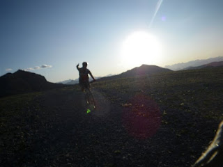
Looking west from South Baldy, Kananskis Country

Looking west from South Baldy, Kananskis Country
Showing posts with label Moose mountain. Show all posts

Friday, 29 July 2016

North Ridge of Moose Mountain

A Hike-a-Bike up Moose Mountain's North Ridge

Moose Mountain occupies a huge sector of Calgary's mountain panorama. Most people who hike or bike up it do so from the southern well road ("the Moose Mountain Road"), off Highway 66. The problems with that are that: 

- It is a crowded route;
- Unless approaching via the Pneuma or Moosepacker trails, you miss out most of the ascent; and
- It only takes in part of Moose Mountain's skyline.

I'd done the tourist route many times, and had always regarded the other ridges with interest. This is my brief account of taking the North Ridge approach.

The route is described by Gillean Daffern, although this is a trip for which her compound approach to descriptions caused me some confusion. IMO it's best to just use the Gem Trek map, and forget the book, unless you want to extend the day substantially by taking cut lines etc. instead of the direct approach.

From the Pine Woods picnic area (washroom and non-potable water pump) we immediately took the wrong route. The map suggested that we could descend to a creek directly underneath the parking area, then pick up a cut-through trail to the Husky well road that would take us to the end of the biking section. Unfortunately, the 2013 flood removed a bridge here, so we started the day with wet feet. If you do this route, ride north from the parking lot for 500 m, until you reach the gated well road junction, then descend to a bridge, and continue towards Moose Mountain.

The road is about 14 km long. At least 13 km of it is uphill, and I ended up walking several times. The extra weight of hiking gear, boots, and water made quite a difference. Eventually, after passing several oil and gas facilities, we skirted the main site (the only staffed facility), and continued for 2 km uphill to the col and well pad below the north ridge. Partway up this leg, we noticed a cairn that I believe marked the faint trail to Jumpingpound Mountain. We dumped our bikes behind a berm, changed, and headed off uphill through some lovely meadows that offered great views. 

Cycling up the road to Moose Mtn North Ridge
Moose Mountain's north ridge, leading to the summit, seen from the interminable well road.
Hiking moose mountain
On the meadows where the North Ridge kicks up. It's raining in Calgary!
The summit of the North Ridge is only a little lower than the main summit.
The north ridge turned out to be a pleasant almost-scramble, along a narrow rocky ridge. Part way along there was a shovel standing upright in a cairn. I've asked around, but nobody seems to know the story behind this oddity. It's been there for a good few years.

Moose Mountain north ridge
Andy descends from the main summit, passing a memorial stone.
The final few metres were fairly steep, but the footing is OK, and after a short climb, the ridge met the main trail. On the descent we noticed a memorial stone (it's down past the fire lookout's biffy, if you want to take a look). 

Moose Mountain North Ridge
Lovely meadows on the descent, near the well pad.
The descent was insanely fast. Overall the trip included around 29 km of riding, and 4 km of hiking. It's not a long day per se, but the continuous uphill grind on the bike is sure to take its toll. Fortunately Andy had sneaked a couple of chilled beers into his cooler, so getting into the baking-hot car afterwards was a little easier than it might have been.

Wednesday, 22 July 2009

Night on Moose Mountain

Ian on the last zig-zagThe closest Rocky Mountain to the city of Calgary (I can see it from my office window), Moose Mountain makes a great evening's MTB ride. You can ride it from Highway 66 if you have the time and energy (around 30 km and 1,000 m of climbing), taking advantage of the Moose Mountain Bike Trails Society's trail network, or you can drive to the top of the oil access road and cut the trip to a mere 15 km and 350 m height gain. We opted for the latter, and I was glad of it - we finished not far shy of darkness.

For this ride I was joined again by Ian Stewart, and the weather was perfect; after a hot day a light breeze was raking the mountain. The early trail sections are generally rolling, with good packed dirt, after an initial iffy 50 m downhill on loose cobbles and rock - 'Iffy' as in, 'If I fall off at this speed, will I break my leg?'.False summit

The crux of the route is the xig-zags, which are a mixture of ridable stone and deep gravel, particularly on the hairpins. I pushed several times on this section, but the scenery was good enough to take my mind off it. We were overtaken by fell runners here, too. Those guys were so fast that we failed to catch them again on the downhill.


After the zig-zags, the false summit. This is a lovely open bit of ground and the point where the views to the west start to open up. Last night visibility was perfect and the mountainside deserted - for me this was what it's all about.


Eventually you have to ditch the bike and hike the last few hundred metres to the summit. The fire ranger Fun on the descentthere invited us to ride the path back down, but that looked like a sure route to blazing a new double-black diamond downhill course on the side of the mountain - we opted out. On the summit, it was hard to believe that 3 hours earlier I'd been at my desk looking across the foothills to this place.

After signing the visitors' book and a quick hike down, we bombed down the mountain in a third of the ascent time. The cobbles and gravel made for some tough riding, but what a fantastic place it was to ride!


Moose Mountain from gas trailhead. ~14.5 km. More pictures here.

View from the lookout helipad

Monday, 30 June 2008

Moose Mountain, May 2008, June 2008

Front ranges view from Moose Mountain From Calgary, Moose Mountain is one of the most easily recognised mountains on the skyline. It's also the closest Rocky, at about 45 km from downtown. At 7,995 ft you're right on the cusp of what might be considered a 'real mountain'. Stand on the fire lookout's helipad and you're probably just about there!

We tried Moose Mtn twice in 2008. The first trip was a little early. We post-holed for 2-3 km before giving up; it turned out that another 100 metres would probably have got us out of the woods and onto a snow-free meadow.....and we missed the chance to be the first that year to sign the summit book. We only realised this when we returned in June, when the hike was straightforward.

Broken hand, shorts, deep snow.  Great fun.
Most books just describe the out-and-back trail that starts high on the mountain from a gas plant road, but a look at the map shows that there are several interesting variations that might be undertaken by hike-and-bike, or on a slightly convoluted circuit.