Looking west from South Baldy, Kananskis Country

Looking west from South Baldy, Kananskis Country

Monday, 11 May 2009

Eagle Lake, Strathmore

Paddling under a big skyEagle Lake, on the prairie 45 minutes east of Calgary is way harder to find and access than to paddle around. Opportunities to launch are severly curtailed, and the only good spot is occupied by a caravan park. In true caravanners' nature, this means that a kayaker wishing to launch is expected to pay $7 per boat. Fortunately there is a second access point, but directions on the web are garbled. It took us a long time and a lot of dirt road driving to find the launch spot. Take highway 817, then township road 232 east. The (gravel) road north to the lake is range road 245, but there is no sign to this effect. There is a tall, brown metal farm building close to this corner. If you can see Namaka Lake on the right then you have gone too far. The launch point is a few km up the road, where the road becomes a grass track, and finally ends. It doesn't look like a great put-in spot, and the mud really stinks, but it is possible to make it out without getting wet/mucky if you udge a little.

SandpiperIs it worth the hassle? Well, the ice thaws here when the mountains are still mantled with snow. Apart from the odd moron on a wet bike, you'll have the place to yourself, and this is a very popular spot for migrating birds. We saw birds here that we've not spotted elsewhere, and there is something satisfying about watching rain sweep in across the prairie, and hearing it pelt the rushes, as you watch the wildlife from your boat.

Black Crowned Night Heron

Saturday, 9 May 2009

A Double Decker Day

Rob on Prairie MtnMy friend Rob Kinsey was staying with us again, at the end of his family holiday. Sofie and daughter Sennen headed to the zoo with Lou, so the boys were free to play, for one day only. We opted for a combination day - a hike up Prairie Mountain followed by a kayak trip on Glenmore Reservoir, then a barbeque and beers on the porch. How Canadian, eh?


If the bears don't kill you, the air probably will.

Our route up Prairie Mountain was a new one to me - I'd recently seen a couple of hikers take a ridge that branches off the Prairie Creek Trail about 1.5 km from the winter gate. This turned out to be an excellent way of reaching the summit ridge of Prairie Mountain. It's still pretty steep, but you get a view all the way up, and are unlikely to cross paths with anyone. I noticed a bad smell a few times - I put it down to Rob's guts and said nothing.

The summit ridge was covered in fresh snow, and low cloud made Moose Mountain look broody. On the last few steps I mentioned an alternative ridge that I'd noticed, which looked like a good scramble. Rob was up for descending it, so we headed down. To get to this ridge, you reverse the first 100 m or so of the summit path, then head left until you can see scree below you, and head for it. It gives a good view of the cornice on the summit ridge, which is actually quite a bit bigger than it appears from the normal route.

The rib turned out to be OK in descent, but wouldn't be much fun to climb up as there was a lot of scree. After a few minutes I could smell rotten eggs again. Rob was nowhere near me - so the other obvious conclusion (for an Albertan) was drawn - we were walking through an area of Hydrogen Sulphide (sour gas) seeps. There wasn't much we could do about it, and a decent breeze was blowing, so we tried to stick to the high ground, and got out of there, fast. The ridge eventually joins a pleasant creekside trail, which brings you to a junction with a well-worn trail after 15 minutes. The left fork then lands you on the road at the winter gate parking area. This made a nice variation on the usual Prairie Mountain routes, and took 2 hours 45 mins round trip.

Cold feetShopping By Kayak

Pelicans


I wanted to show Rob the beaver colony that we'd found on the Elbow River, but after an entertaining paddle through small waves and rain, we found that the water level on Glenmore Reservoir had dropped, and we couldn't get to the river channel. We spent 30 minutes trying, and at one point Rob even braved the cold to try to drag his boat to deeper water, but eventually we gave up. Seeing a flock of pelicans on the lake was a good compromise and so we continued, pLoading the shoppingaddling right around the reservoir. While we were near Heritage Park, Lou called me asking us to go to Safeway.....well, it's only a short walk if you beach the kayaks in the right spot, so I wandered around the supermarket in my kayak gear, getting funny looks and leaving a muddy trail behind me. At the checkout I was offered 'carry out assistance' - unfortunately it transpired that they didn't include loading shopping into kayaks in the service, so I had to decline.....

It's funny how a poor forecast will give you the hills and lakes to yourself out here: we saw three people on the summit ridge of Prairie Mountain, and two kayakers on the reservoir, right at the end. Definitely a good day out!

Update on The Ice Breakup

When does the ice break up around here for paddling? I couldn't find anything online to help me, so here's a record of how things have been in 2009.

Before May 1: No lakes clear in or west of Calgary. Bow River had cleared early in April.

May 3: Glenmore Reservoir was partially clear, but some icebreaking required to get between the south and north shores. Weaselhead Flats inaccessible. Ghost Reservoir still completely frozen, but looked like it might clear soon.

May 6: Glenmore Reservoir clear.

May 8: Phone call to warden in Barrier Lake info centre indicated that all of the local lakes (Spray, Barrier, K Lakes) are still frozen.

Monday, 4 May 2009

Breaking the ice: Glenmore Reservoir

Lou paddles on the reservoirThe gentle lapping of water against the receding ice, hundreds of wild birds screeching all around us. A steam train hoots in the distance. Snowy mountains on the skyline; fish break the water ahead of my kayak, and a muskrat sits on a rotten log off my bow. So glad I moved to the Rockies and bought a kayak to paddle in the mountain lakes.

The distant sound of a tannoy playing music from a Wild West dancehall, a distant rumble of traffic. Ah, yes - open my eyes and this is central Calgary....

May 3rd and still we have no break-up on the lakes. It's been quite a hard winter, and fresh snow is still blanketing the nearby foothills frequently. We took our kayaks to Glenmore Reservoir, about 10 minutes' drive from our house. The ice hadn't cleared, but at least we could get out onto some water at last.

Muskrat
We followed another paddler out to the ice shelf and then through it, as he battered a path to the western side of the reservoir. Paddling in ice was a new and novel experience. Breaking through is fun so long as the boat stays level. Once you're past the blockage, the bow wave from your boat trails a swishing sound behind you as it lifts the ice. Peaceful.

Through the ice Lou had a good play with her new camera and got some great shots of birds in flight.

My underwater camera got its first dunking too - here's a half-submerged shot of the shore ice.

Underwater shot


A few more shots of paddling that day have been posted here.

Saturday, 2 May 2009

When sixty-six was ninety-two.

Went out for my third road ride of the year yesterday with Simon, who is in training for an Iron Man triathlon. He selected a route from his house that heads out to Cochrane then does a quick loop past Big Hill Springs before returning. '66 km' he said - so I thought 'fine, one bottle of water, no food needed'. Big Mistake. We (I was there, so have to take some blame) missed a turning (which I wasn't aware we were looking for) northwest of Cochrane and ended up waaaaay north of our intended route. This then meant returning up the big hill out of Cochrane, which started at 72 km on the odometer (and ended at 75.5 km). Total distance: 92 km, averaging somewhere over 26 km/h. Man, my legs and backside were aching afterwards! Two things of interest happened during the ride: I met a guy from Wednesfield, England (not many of us ex-Wulfrunians out here), and I noticed the sparkling azure of the Ghost Reservoir in the distance so could plan the next day's kayak trip. Another mistake in the making....

Monday, 20 April 2009

Cycling: Plummer's Road, Millarville and Priddis loops

View from Highway 549The weather station was reading 21 C at lunch time today, and so we headed out for our second ride of the year, just south of Calgary. There are a couple of nice loops that we've found out that way; one is 24 km and the second is 36 km. Neither of us are cycling well after a long winter lay-off, but the roads are good and the scenery is spectacular, so it was a good run. The roads are very straight and the surfaces excellent - I've done nothing in the UK to compare really - they make highways differently out here. One thing that is sobering is the lack of pubs...I'd have loved a pint at the end of my ride. I did notice a nice looking bistro place in Priddis (where for some reason all the kids ride on the left), that might be factored into a ride soon, though. Unfortunately the weather is not really playing: today I read that Professor Falls has collapsed (I had a plan for a sneaky last climb of the season in May), but the forecast for Thursday is a high of 0 C. That's just wrong.....


Tuesday, 14 April 2009

Last ski day of the year? April 12 2009

Another busy day at Sunshine Village
With a forecast for fresh snow we headed to Sunshine on Easter Sunday. We expected long queues and packed pistes, but in the event the place was dead - due to a lack of foreign holidaymakers coupled with Canadians doing the family dinner thing perhaps - plus it was sunny in Calgary. The morning snow was ice under fresh almost-powder but by lunch time things were good. The extra effort of skiing over icy ruts made a big difference - even super-fit Frans was knackered by 3 pm. The season runs for another 4-5 weeks but I think we'll be hoping for break-up on the lakes well before that, so we can get the boats out.

Monday, 13 April 2009

April 10 2009: Hell's Ridge North

Lou Burdett on the open summit section of Hell's Ridge
Hell's Ridge North looked like a good candidate for a 'shoulder season' hike. It's in the Mike Potter guide "Ridgewalks in the Canadian Rockies". In truth, it was an absolute git of a day out, with admittedly interesting views not quite making up for slogging through deep wet snow for several hours. It was our first outing using this guide, and initial observations are that the facts are not very exact. This isn't really helped by the Gem Treks sheet for the area. which contains errors in distances that attack your confidence right at the end of the route, as the daylight begins to fade, and you don't recognise the large animal tracks in the snow that seem to get more frequent as you start to turn 180 degrees away from the point where you know you need to cross a creek that may or may not be a rushing meltwater torrent.


Still, it all worked out in the end, and although the stark statistic of 8 km hiking in 7 hours looks bad on paper, my legs were killing afterwards, so all that high-stepping and step-kicking must have been to some effect. And by now I've finally got all the pine needles out of my underwear....

Full photo set for this hike

Wednesday, 25 March 2009

King Creek, Moonlight, Junkyards, Haffner Creek.

Frank on Second Seep, King CreekLink to pics of Moonlight, King Creek, Junkyards, Haffner Creek and Sunshine Village.

Frank came over for his annual winter visit, and we headed out for a few days of fantastic ice and skiing. We had been worried that by late March our options would be limited, but in truth it was the best climbing I've had all winter.

As I write this up on April 18, reports are still appearing of fantastic conditions on low altitude Rockies ice - but I'm off out for a sunny bike ride!

The week started with a trip to King Creek (above) in Kananaskis Country. The three seeps were in good condition at around WI2+ to WI3, although fresh snow made climbing the easy-angled First Seep less fun.

Day two saw us in Evan Thomas Creek, where we joined Grant for an ascent of Moonlight (WI4). Superb, sustained climbing and we saw two moose in the woods.

On day three we headed to the Junkyards and climbed the Scottish Gully, amongst others. The ice was super-fat and there were lines available that weren't formed on previous visits. The following day we skied at Lake Louise, and enjoyed the Rock Garden....great fun unless you miss a turn, then it's time to learn about the reason behind the name....

Our fourth day was spent at Haffner Creek. Again, the ice was superb and we climbed several good, short lines. After that, we decided to relax with a day at Sunshine Village. It was completely empty, and we had some great skiing, including a full descent of my first double black run - actually easier than many of the local single blacks, but longer and in a more remote position off the side of Goat's Eye Mountain. All in all, a great week!

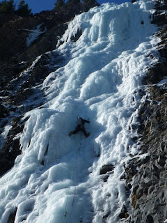
Frank in action, Canmore Junyards
Grant Parkin leading Moonlight, Evan Thomas Creek

Saturday, 7 March 2009

Wicked Wanda WI4+, Ghost River Valley

What an amazing piece of ice this was! We went up in a team of four to get some film of Grant climbing through the overhangs on the right of the upper pitch. The normal route goes left at WI4+, but Grant thought he might be able to squeeze through a hole in the back of the roof for a variant finish.

I filmed a couple of hours of footage, and captured the moment when a masive block of ice detached under Grant's weight (see below). Unfortunately I had some computer problems shortly afterwards, so the editing is going to take a while. Still, here is a set of pictures from the climb.


Sunday, 1 March 2009

Green Monster, Rehab Wall, upper Evan Thomas Creek

Will Meinen leading Green Monster, WI3+, Rehab Wall
Click here for full report

In an attempt to link my photo albums to a single point of reference, I'm going to retro-post details of various trips we made last year onto this blog. Things will calm down in a couple of weeks, but until then, here is the first of a series links to short write-ups of climbs, hikes, rides and paddles that we did in late 2007 to early 2009.

Green Monster is at the left end of 'Rehab Wall', which is a reasonably long walk up Evan Thomas Creek, in Kananaskis Country . The routes here are not presently in a guidebook, but there are half a dozen good, single pitch ice routes and a wall of hard, bolted mixed climbing that is said to be 'the new Haffner'. On the day that we climbed there, it was somewhere around -30C and I lost all feeling in four of my fingers for 3 weeks afterwards. I had warm feet though - resulting from a combination of wearing my ancient plastic boots, and changing my socks when we got to the route. That's a top tip from Grant - dry socks don't conduct heat like wet ones and in those temperatures it makes a massive difference to your comfort (and potentially, your toe count!).

Monday, 9 February 2009

Prairie Mountain Loop in Winter

Sunny day on Prairie MtnPrairie Mountain is one of our closest hills. At well under 8,000 ft, it's not really much of a mountain at all - but the treeline is below the summit, so that's that. It's a good steep hike that can be done at pretty much any time of year. What is not done so often is the loop that goes off the back of the mountain - in fact, I've yet to see a reference to this in any guide or web log. We did it in February - that's a good time to do it since you are well off trail, and in thick forest for some of the descent, so it was nice not to be worrying about bears.

Failing light, long way home....


Full Photo Set & Hike Info

Sunday, 1 February 2009

Return to the hand breaker: West Bragg Creek ski trails

On April 25th last year I went Nordic skiing on a hot day (over 20C) at West Bragg Creek. The trail was beyond my abilities, and about 2 km from the end, I hit a patch of gravel exposed by the rapidly melting snow. Pitching headlong down the slope, I punched through the snowbase to a perfectly-positioned cobble. Result: spiral fracture of 3rd metacarpal, right at the start of the climbing and cycling season.

Nine months later Lou and I returned to the scene of the accident and skiied a couple of loops at West Bragg Creek. On our second day back, I tried the same hill again.....and in the elation of making it to the bottom unscathed, I hit a bump and fell. This time, fortunately, there was no lurking rock under the snow.

West Bragg Creek is a nice place to head to from Calgary for some free skiing, thanks to the efforts of the local track setting group. You can download a trail map here, and see trail conditions here. Also, I took some pics of our return visit.


Kananaskis Interpretive Canyon

Joe Lenham leading at Interpretive CanyonThis little ice climbing venue doesn't get much exposure: it is not featured in the existing guide, but it does get discussed occasionally online.

I put together a sketch of the available lines (left), before I had climbed much Rockies ice - it's overgraded to be honest; the line marked WI4- is a short and simple WI3 at most. It's a nice place for a quiet half-day, although it's quite the drive if you live in the southern regions of Calgary.

Link to Full Photo Album


The back wall, less visited

Saturday, 24 January 2009

Albatross WI3, Valley of The Birds, North Ghost River Valley

Steaming water on river crossing
The Valley of The Birds lies in the northern Ghost River Valley, about 12 km from the Big Hill. It's a narrow, step-sided little valley accessed via a cleft that forms up as a series of short WI2 steps. On the day that I went there, it was pretty cold (maybe -27C or so) and the river crossings required to get to the valley produced instant armour plating on your boots - I was very glad I was wearing plastics that day.

There are several routes in the valley, pictured here. We did Albatross (WI3) which I found hard, as it was plating horribly and had thin sections and other parts where the ice was skinned so that you were climbing on a thin crust above a deep air pocket. This was certainly not my favourite route of the winter, but the setting is fantastic.

Joe on Albatross

Thursday, 22 January 2009

Tim's Winter Visit, 2009

Walking in to Grotto FallsTim Capon loved the Rockies in summer so much that he returned for a winter visit in January 2009. It was great to see him over here again, and we made the most of some great snow and ice conditions to get out and do some early-season stuff.


Highlights of his trip included climbing Grotto Falls (WI3), and skiing some amazing snow conditions at Sunshine Village. We also took in a half-day of Nordic skiing at the Canmore Olympic Centre. The trails were a bit thin in places but Tim survived the inevitable first-timer's tumbles without any lasting damage.


Lou on Grotto FallsOoops

Sunday, 18 January 2009

Chantilly Falls, WI2, Evan Thomas Creek

Chantilly Falls is a lovely WI2 in the Evan Thomas Creek, off Highway 40 in Kananaskis Country. The walk-in is about 45-60 minutes and the climb is 80 m or so, in two pitches, with the crux where it should be. It's a really nice day out - I enjoyed it so much that did it twice in the 2009 season.

Full photo set

On this outing Grant and I were joined by Meaghan and Tim from Calgary. We had great views of the Fortress on the approach (left).

Meaghan climbing the steep little final wall (below).

Thursday, 1 January 2009

Cross Country Skiing in Fish Creek, Calgary

Winter's here againThe great thing about living in SW Calgary is the availability of local Nordic skiing when we get a good dump. The winter of 2008/9 waited until mid December to bite, then hit us with cold weather (left) and masses of snow. I live close to Fish Creek, and was able to get out a few times on my skinny skis. I'd like to say I'm improving my technique on these treacherous strips of plastic....but I still fall over a lot. No broken bones this year though.

Skiing on Fish Creek near my home
One thing that was almost quite good (in retrospect!) was Christmas Eve, when I caught the bus to Fish Creek LRT station (funny looks) and then skied to my office, 16 km around the rivers. The going was actually really poor, despite all the snow - off-trail I was breaking through 2 feet of drifted snow and snagging on underlying vegetation. Cue falls and a lot of loud swearing.....but at that time of day the park was empty. On trail, I was lucky if the parks dept had left a cm of snow on the edge of the path to skim along. I'm not planning on repeating this journey - it took me 3 hours, with the last 3 km mainly done on foot due to over-zealous trail scraping (read: removal of gravel to 2 cm below previous path elevation) by contractors along the Bow River trails. And then to add insult to injury, Riverbend McDonalds wouldn't cook me a burger because it wasn't 11 AM yet. They had no idea how much the thought of that burger had fuelled my skiing....sometimes a granola bar just doesn't hit the spot.

Saturday, 20 December 2008

Waxy Referendum - the climb that never was

Paul Warman descending Hood Creek log jamHere is a picture (left) of Paul Warman descending the log jam in Hood Creek (Kananaskis Country). What a day! We had gone to climb Waxy Referendum (WI3, 100 m), but the guidebook really bummed out on its description of the approach. The cited approach time is 90 minutes; after 5 hours of hiking in fairly light snow conditions we turned around. The guidebook writer had cryptically suggested that approaching this climb via Hood Creek was a bad idea. After five hours of toil for no result, the route came into sight maybe 30 minutes above us, but the light was already failing. At this point we decided that this book really couldn't be trusted! Ninety minutes of descent later, we hit a 20 m high jam comprising thousands of logs wedged into a narrow canyon, and had to abseil down, avoiding pools at the bottom. So now we know why Hood Creek is a bad idea - but not why the FA forgot how long the approach took!

Saturday, 20 September 2008

Climbing in the South Ghost River Valley

South Ghost River Valley, looking west The Ghost River Valley is about 90 minutes from Calgary, accessed via a gravel road and then a section of road that requires a 4 x 4. Despite being close to Calgary and Cochrane, it's a remote place to climb and help is a long way away if you get in trouble. There are many kilometres of cliff here, and probably untold unclimbed lines - but the rock is steep and often loose, so the sitaution is unlikely to change.


Here are some pictures from a rock climbing trip into the Ghost that I made with Grant, local access worker and Ghost afficionado. I found the climbing tough - I'm still not used to the YDS grading, but it seems to me that if the rock is loose and the protection dubious, then the tech grade within the overall grade calculation should slide....this doesn't happen here though. Until I get my head around this one, I'm not leading much trad rock here!Big Rock for the Big Rocks

Sunday, 14 September 2008

Ucluelet, Vancouver Island

Early morning, UclueletOur summer holiday in 2008 was a trip to Vancouver Island, staying in Victoria and Ucluelet. It was a fantastic place to visit, marred only by the people on the campsite and poor management of the site itself. Why fly and drive all the way to Ucluelet to sit outside your tent, making a racket, never leaving the site except to shop, and strewing your food and rubbish around, attracting bears? I really can't get to grips with this concept; even from the tent we watched otters, eagles and bears foraging the far shore, yet the people camped around us never even turned their heads towards the sea. We left the site early as we got fed up with the situation - two young, hungry bears had come into the area, attracted by food that people were leaving out overnight. Eventually, when it was looking inevitable that the bears would be shot, we headed south a day early. I wouldn't recommend the Ucluelet campsite to anybody until they sort out their wildlife management policy and start cracking down on some of the idiots that stay there. Unfortunately it's not in a national park, so the only recourse for complaint was the RCMP.

Saturday, 30 August 2008

Tofino Sea Kayak

Paddling towards Strathcona mountainsNear the end of our holiday in Ucluelet we booked onto a guided sea kayak trip. This was a group outing, with five clients and one instructor - by coincidence all of the clients were British.
Small starfishWe headed out into Clayoquot Sound and paddled towards the distant mountains of Strathcona Park. We didn't see any big wildlife (just one seal) but there were loads of birds, including nesting bald eagles with a juvenile, and the biggest starfish I've ever seen - almost a metre across! The trip was awesome and it's definitely something I'd like to go back and do more of.

Friday, 15 August 2008

Sea Bears!

Black bear eating If you want to see bears close up without disturbing them, booking onto a bear spotting boat trip is a good way to do it. These pictures were taken on a guided Zodiac tour of the coast around Ucleulet.

Sunday, 27 July 2008

Kayaking on Barrier Lake

Lou Burdett on Barrier LakeAfter a trip to Waterton Lakes where the rental rate for a canoe was extortionate, Lou and I decided to buy recreational/touring kayaks so that we could drift around the Rockies lakes. Here are some pictures from our first outing, on Barrier Lake (actually a reservoir), in Kananaskis Country. This is about 75 mins drive from home.

Kayaking on Lower Kananaskis Lake & Climbing on Cowbell Crag.

Lower K LakeTim Capon came out to visit us from London, and we headed off for a long weekend's camping in Kananaskis Country. We had reservations about camping near Calgary - we'd heard too many horror stories about loud, all-night drinking parties at Bow Valley sites (why can't people who want to actively destroy the natural environment for the weekend just stay at home? Different country, same attitude...). In the event, the Canyon campsite in K Country turned out to be quiet, well run and a great place to stay - but get there early.


Topping out on Cowbell CragWe took the boats out twice on Lower Kananaskis Lake, which is set in a spectacular location. On Sunday we hiked up the Indefatigueable Trail, which overlooks Lower K Lake. We were then joined by Alex and Kathryn from Calgary, and headed south to climb on Cowbell Crag, an unusual trad venue formed from a tilted plane of conglomerate. A rope of five made for an interesting outing up a long pitch of 5.6, but it turned out to be a good route, under the encroaching dirt and vegetation.

More pics from this trip here.

Sunday, 13 July 2008

Crypt Lake, Waterton Lakes National Park, Alberta

Crypt Falls and beargrassThis hike is probably the most famous in the Waterton Lakes park, featuring a lake crossing, several waterfalls, a ford, a tunnel and exposed wire traverse. Swimming in Crypt Lake is optional! It gets busy in a limited way: the first stage of the trip is to pay the ferryman. That limits numbers on the trail to however many hikers fit on the boat from Waterton Townsite.

Once on the shore, people string out along the trail gradually. To avoid this, take the right-hand fork after a few hundred metres and approach Crypt Lake Trail via Hell Roaring Falls instead. I think this is a nicer way of doing things anyway, as Hell Roaring is nowhere near as spectacular as the Crypt Falls, so this way you avoid an anticlimax. Appearing in this album: Jeroen, Joe, Lou, Nikki, Tristan and Vicki.

Lou Burdett in the tunnel section

Incidentally, Crypt Falls goes at about WI4 in winter....if you can get there. For a taste of winter...go for a dip! I have never swum in such cold water.


Joe swimming in Crypt Lake, July 2008


Summit Lake Hike, Waterton Lakes

Tristan and Vicki at Summit LakeSummit Lake, in Waterton Lakes National Park, is a fine little hike that gives great views south into Glacier National Park, USA. There's a great linear walk that continues from here down to Upper Waterton Lake, over 24 km. We just hiked the short trail to Summit Lake though. We saw no bears on this walk, but did spot three in a nearby valley, when we were driving around. they were being shooed up the hill by a guy - we thought perhaps they'd got too close to the campsite.
Pricey paddling
It was on this trip that we decided to buy kayaks. There was a canoe rental outfit on the shore, charging something like $30 per 30 mins and $10 per swapped paddler. A quick sum showed that we'd get that money back very quickly if we just bought some boats.....it's easy to convince yourself on a hot mountain lakeside day!