Mt. Fullerton is part of the southwestern Calgary skyline. Despite its modest height (2,728 m / 8,950 ft) it is a fine day out, requiring a round trip of around 26 km (16 miles) via the easier of its two 'popular' ridges: the northeast.
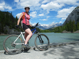
Tristan and I did this as a hike-a-bike. Kane, Williams and others recommend ditching the bike at the Nihahi Creek/Little Elbow junction and walking from there, but one web author suggests riding the entire approach. We tried this, but gave up on the bikes about 1 km after the junction. If we'd persisted for another 10-15 minutes we might have cut 60-90 minutes off the round trip time, as the riding does improve once the valley widens.


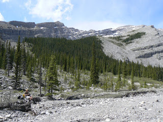
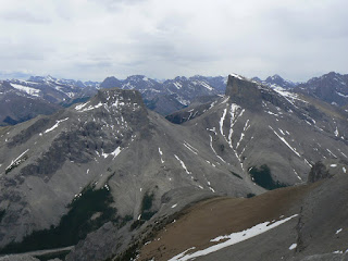
The scramble is straightforward. We followed the Kane description up a drainage that was still choked with snow that had an annoying habit of collapsing underfoot. A faint trail was visible here. From the top of the drainage, you gain the ridge to the right, and scramble enjoyably over solid rock for rather further than you expect, direct to the narrow summit. The register showed 11 ascents for the previous year; this is no honeypot peak despite its visibility from Calgary. Our Canada Day ascent was the first of 2010. From the summit ridge we had fine views of the Elbow area, plus further peaks such as Assiniboine. I was intrigued by a narrow side-slope trail that disappears towards Mt. Howard, as there is no sign of a trail in the main valley and this would be a very long approach to Howard, making for something like a 35 km day.

The scramble descent was fun, although the valley walking section did drag somewhat - the narrowing of the valley ahead didn't seem to draw any nearer for a long time. Biking out was awesome, although quite technical, particularly descending the switchbacks. I almost came a cropper above the little gorge that closes the valley when my SPD wouldn't unclip and instead of putting down my upslope foot, I fell headlong downslope, still attached to my bike, stopping a few feet above the cliff edge. The rest of the ride out was way more fun. The trip took 7 hours car-to-car. Recommended for a quiet day out, although my legs have been aching all night!
 My friend Keith (sporting a 'Game Over' T shirt throughout his stag weekend) recently got married. To commiserate, a bunch of us paddled some of the Red Deer River for a couple of days. There are many reaches of this river to explore within a couple of hours of Calgary; we took on a fairly short stretch close to Trocchu.
  In the mean time if you see this man on the streets of Plymouth.....cross the road immediately, and don't look at him directly!


