A Hike-a-Bike up Moose Mountain's North Ridge
Moose Mountain occupies a huge sector of Calgary's mountain panorama. Most people who hike or bike up it do so from the southern well road ("the Moose Mountain Road"), off Highway 66. The problems with that are that:
- It is a crowded route;
- Unless approaching via the Pneuma or Moosepacker trails, you miss out most of the ascent; and
- It only takes in part of Moose Mountain's skyline.
I'd done the tourist route many times, and had always regarded the other ridges with interest. This is my brief account of taking the North Ridge approach.
The route is described by Gillean Daffern, although this is a trip for which her compound approach to descriptions caused me some confusion. IMO it's best to just use the Gem Trek map, and forget the book, unless you want to extend the day substantially by taking cut lines etc. instead of the direct approach.
From the Pine Woods picnic area (washroom and non-potable water pump) we immediately took the wrong route. The map suggested that we could descend to a creek directly underneath the parking area, then pick up a cut-through trail to the Husky well road that would take us to the end of the biking section. Unfortunately, the 2013 flood removed a bridge here, so we started the day with wet feet. If you do this route, ride north from the parking lot for 500 m, until you reach the gated well road junction, then descend to a bridge, and continue towards Moose Mountain.
The road is about 14 km long. At least 13 km of it is uphill, and I ended up walking several times. The extra weight of hiking gear, boots, and water made quite a difference. Eventually, after passing several oil and gas facilities, we skirted the main site (the only staffed facility), and continued for 2 km uphill to the col and well pad below the north ridge. Partway up this leg, we noticed a cairn that I believe marked the faint trail to Jumpingpound Mountain. We dumped our bikes behind a berm, changed, and headed off uphill through some lovely meadows that offered great views.
 |
| Moose Mountain's north ridge, leading to the summit, seen from the interminable well road. |
 |
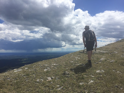
| On the meadows where the North Ridge kicks up. It's raining in Calgary! |
 |
| The summit of the North Ridge is only a little lower than the main summit. |
The north ridge turned out to be a pleasant almost-scramble, along a narrow rocky ridge. Part way along there was a shovel standing upright in a cairn. I've asked around, but nobody seems to know the story behind this oddity. It's been there for a good few years.
 |
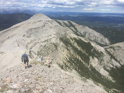
| Andy descends from the main summit, passing a memorial stone. |
The final few metres were fairly steep, but the footing is OK, and after a short climb, the ridge met the main trail. On the descent we noticed a memorial stone (it's down past the fire lookout's biffy, if you want to take a look).
 |
| Lovely meadows on the descent, near the well pad. |
The descent was insanely fast. Overall the trip included around 29 km of riding, and 4 km of hiking. It's not a long day per se, but the continuous uphill grind on the bike is sure to take its toll. Fortunately Andy had sneaked a couple of chilled beers into his cooler, so getting into the baking-hot car afterwards was a little easier than it might have been.

No comments:
Post a Comment