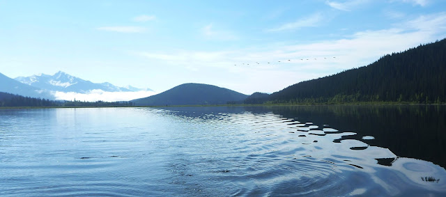
Canoeing the Bowron Lakes
There are two western Canadian conversations that recur too often in the outdoor world. One starts like this:
"So, you're a canoeist then? Oh, have you done the Bowron Lakes?"
A negative reply will inevitably cause your questioner's eyes to glaze over, as the idea that you might be a "proper canoeist" (or worse, "proper canoer") becomes irretrievably dismissed from their mind.
Such is the place of the Bowron Chain paddle in the local rites of passage. (For the other conversation, substitute "West Coast Trail", and "hiker"). This has created a weird division between those who believe themselves to be certified "outdoors people" because they have completed these two trips, and those who won't consider trying either of them because they'll be thronged with people from the first group. Mention the Bowron Lakes to most regular canoe trippers, and they'll ask "why would you bother? It's busy. It's boring. It's further away than northern Saskatchewan. AND you have to pay!" Given what I'd heard, it wasn't a trip that I had any desire to undertake, but then I found myself with time on my hands, and needing something that I could do on my own, or, as it turned out, with a friend who had retired, and could go at short notice. The official season begins around 15 May, and we thought that if we went early, it might not be so busy, although we were expecting crowds at every campsite.
We were really glad that we went. It's a fantastic trip, and compared to northern paddling, it's a luxury excursion! I'd certainly do it again, but only in the spring, when the water is high, your fellow paddlers will be few, and the bugs die off every night.
The circuit is located in BC, roughly between Kamloops and Prince George, near the town of Wells - about 12 hours' drive from Calgary. It is about 116 km in length, and approximately rectangular. Most of it lies within the Cariboo Mountains. The longest single lake segment of the chain is Isaac Lake, measuring about 38 km. The lakes are connected by a mixture of rivers, creeks, and portage trails; there are eight of the latter, ranging between 400 m and 2.8 km in length. There's a good FAQ page
here.
 Map of the Bowron Circuit. You begin in the NW corner, and progress clockwise.
We decided to do the trip just five days before we departed. Packing was pretty simple, although we still took too much gear. The plan was to run this as a one-portage trip, i.e. we would not be walking back for a second load. The first day features 6 km of portages; yo-yoing each one would have become tiresome. They park's rules (of which there are many) allow the use of carts, and most trails make for pretty easy rolling, so a one-way portage policy works out well.
The park is furnished with numerous cooking shelters and cabins. Also, every campsite has at least one pit toilet, and firewood is provided at designated "wood lots" around the circuit. It's a far cry from any of my previous trips, but the circuit has been a victim of its own success; in any given year more than 5,000 people will undertake either the full loop, or smaller western circuit. This has stressed the natural environment, and BC Parks has responded by implementing and enforcing a fairly comprehensive set of regulations, while providing facilities such as toilets and bear lockers at every necessary location. When you arrive for your briefing (pre-booked, for 9 AM or 12 PM), they show you a video and run through the rules, which include a ban on cans, tins, glass, bear bangers, and various other items that lead to problems in the hands of the wrong people. One statistic that hit home concerned bears: before the bear lockers were installed 10-15 bears per year were destroyed as a result of habituation. After installation, not one bear has been destroyed in the park. That's pretty amazing!
We began our trip in Wells, where we stayed at the
Wells Hotel. Before May Long Weekend, the town is pretty dead, and the hotel rates are relatively low (~$80 bed-only). Don't arrive in town much after 8 PM out of season and expect to eat or get a beer though - you'll be gambling on an empty stomach! We got lucky. The bar stocks a great range of beers and whiskeys, and we enjoyed a chat and a drink with the barman - himself a paddler from the Yukon.
No problems parking at The Wells Hotel, off-season.
 Many of the buildings in this hippy, former mining town are brightly painted.
The next morning, we grabbed a final cooked breakfast at the local cafe/restaurant, and picked up a cart for the boat at
Beckers Lodge. Beckers gets some bad press on "Trip Adviser", but I'm not a fan of that site, and I decided - rightly - to ignore what I'd read. We found the Beckers staff most helpful and friendly. I get the impression that they (and the Park staff) deal with a lot of non-paddlers, who arrive with unrealistic expectations. We paid about $40 for our cart; rental is a flat rate for up to 14 days.
In the parking lot there are examples of every trail marker and feature that you will encounter, and a scale to weigh your gear. There's a load limit of 60 lbs per canoe (not including the weight of the boat) when portaging. With the briefing out of the way, we hit the trail. Immediately, we passed a couple of fellow paddlers who had started out shuttling their gear by hand, but had quickly realized that a cart would be a good idea. We also met two older guys who were on their 20th trip around the circuit. One of them was completely blind. That's pretty awesome.

At the weighing station with our boat, cart and impedimentia
So we'd already seen four people. I was starting to wonder if we'd be able to find a campground that night...
From the FAQ:
Q. What is the average number of people on the Circuit in June/July/August/September.?
June 800, July 1,700, Aug. 1,700, Sept. 800
Yep.
1,700 people! I think that means for the whole month though (based on 5,000 per year). If the average trip lasts 8.5 days then that's around 500 people on the circuit at any given time in high season - roughly nine people per campsite, or four per kilometre of travel. Sounds awful? Well then, try going in May!
On the day that we left, there were 23 registered paddlers already on the circuit.
We saw four people in the parking lot.
On day 2 we saw a canoe beached on Isaac Lake.
On Day 3, we saw a Ranger, who apologized for disturbing our trip with her outboard engine noise.
It was only on Day 5 that we saw another paddler close enough to speak to - and that was in the middle of May Long Weekend!
We never had to share a night-time campsite, cooking shelter or cabin.
Day One: Start to Wolverine Bay.
We left the Warden's cabin at 12, and started up the mild incline. Evan had a barrel on his chest, and a bag on his back. I had a fairly light barrel on my back, and took the canoe. Progress was rapid, until I hit the first bump in the trail after about 200 m, at which point the cart flipped, and I had to pull 19.5 feet of loaded canoe out of the ditch. That happened four times in as many minutes, before we figured out a system whereby Evan steadied the back of the boat, and we slowed for every dip, root and rock. We still had a few rollovers during the week, but things definitely improved.
Evan found our first portage trail pile-up amusing. By the fourth time, however, this event was losing its shine...
Kibee and Indian Point Lakes were soon behind us; 6 km of portaging and 9 km of paddling completed very easily, and it was only mid-afternoon. We pushed on down Isaac lake, expecting to run into a crowd at the first cabin, and at the cooking shelter at Wolverine Bay. As we approached Wolverine Bay the rain cleared, and a rainbow appeared, one end rooted at our destination. We were amazed to find both of them deserted. We threw up the tents at Wolverine bay, and enjoyed a quiet evening, and slept well, having cut roughly 23 km from the circuit in half a day.
Rainbow on Isaac Lake
Returning from our first "Woodlot" shopping trip.
Wolverine Bay cooking shelter, on Isaac Lake. The front is perspex-walled against the wind; this welcome feature varies between shelters.
Bedtime view of Isaac Lake from the tent.
It's amazing just how widely two people can spread their barrel crap when there's nobody else at the shelter!
Day Two: Isaac lake - Wolverine Bay to Isaac River.
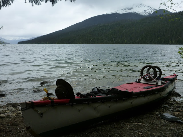
We were up early, and I took the bow seat again, using a kayak paddle. In the Itasca that we were paddling, this worked well, because the bow paddler provides roughly twice as much power as they would if using a single blade. In flat water, the stern paddler mostly paddles forwards, but in wind and waves, they just hang on for grim life, trying to rudder the boat. That sounds like a exaggeration, but we have a full deck on the Itasca, so we can be out in conditions that would swamp most canoes. That came in handy today.
We checked out the sleeping shelter (cabin) at camp 18. Someone had left a maul there; they'd have regretted that - the wood at the wood lots is mostly fresh, and a normal axe does not split it easily. A maul is a far better choice. Soon after this, we saw our first cow moose of the circuit, wandering along the shore.
Cow moose on the shore.
The team in action. I was pleased with my hat/jacket/spray deck combination - I stayed warm despite the conditions.
Brewing up at Isaac Lake sleeping cabin.
Isaac Lake.
Halfway down Isaac Lake, Betty Wendle Creek hits the valley at a right-angle. As we neared the junction, a headwind began to build. It wasn't too bad until we got about midway across the Wendle valley mouth, where the direction shifted to a tailwind, and waves soon began to form. We paddled on, aware that whitecaps were now present across the lake, and every wave was breaking around the boat. The bow was regularly lifting two feet into the air, then plunging to within four inches of the surface. I cranked up the power some more, and we tried to angle the boat to reach a prominent point that we'd have to get around. For a few minutes this was alright, although it meant angling farther out into the lake, away from the shore.
Waves begin to build.
Whitecaps and a breaking wave to the left.
Looking southeast over passing waves.
This strategy seemed to be working. Evan was hanging hard on the stern rudder, and I was pulling for all I was worth in the bow. We were making slow, rolling progress while waves seethed past us down the lake; white foam on cold black water. Then wind threw a tantrum at our refusal to be pushed to the shore, and picked up the surface of the lake, before dashing it across us in a huge cloud of spray. I've seen that kind of water blow up previously, on Waterton Lake; at the point when orderly waves become a chaotic maelstrom, it's time to be onshore. Unfortunately there was no shore; at this point the mountains fell directly into the water. We couldn't hold out line across the bay to the point, and we were forced to run with the wind, then pull a tacking move, and fight our way back out into the lake, before turning and running on the wind again. It was a bit scary. As we passed the point, the waves died off somewhat though, and the situation eased. That was a more worrying situation than on almost any of the whitewater that I have run.
We spotted a green Hellman canoe pulled up on the beach. Later in the trip we learned that it belonged to a young Swiss couple. They'd been shipping water heavily in the waves, and had to abandon paddling until the next day. We were glad of the Itasca's deck!
Beached after the worst section of windy paddling.
After passing some small but spectacular waterfalls, we reached the deserted Isaac River cooking shelter about seven hours after leaving Wolverine Bay. With another 32 km covered, we were almost halfway home already, but my arms and elbows were complaining loudly. We agreed to slow down and enjoy the trip from this point onward.
At the Isaac River campground I spotted an evil-looking plant. I'd never seen Devil's Club before, but knew the name - and there could be no doubt what I was looking at!
Devil's Club - a most disgusting plant!.
Camped at the southeastern end of Isaac Lake, glad to have finished the longest stretch of open water on the circuit.
That evening, the wind dropped and the sky cleared. I was awake around 3 AM and enjoyed a moonlit views of the lake, river, and mountains as the sky faded to dawn.
Isaac River by moonlight.
Day Three: Isaac River to Lanezi Lake Shelter
The next morning dawned calmly, and we were treated to some blue sky for the first time.
Morning calm on Isaac Lake
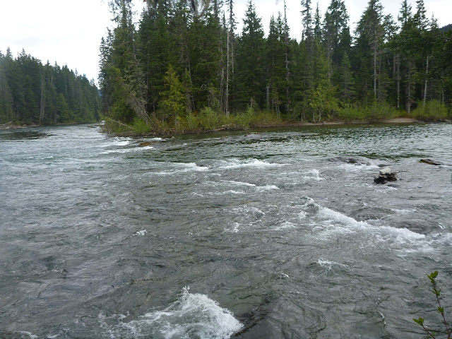
The Isaac River cooking shelter is located right on the only proper moving water of the circuit.: "The Chute". The current guidebook rhapsodizes over the paddling moved required to navigate this feature, taking several pages to describe it; that left us at a bit of a loss. Here's what they maybe should have said:
1. On approach, move slightly right of the middle of the vee.
2. When you pass the rocks on the right, move rightwards, but stay in the moving water.
3. Job done.
"The Chute". Not exactly the Upper Kan!
Beyond The Chute was a fun little stretch of moving water, before a portage around the impressive Cascades, leading to another short stretch of river, which, in turn, was followed by another portage, this time around the 11 m high Isaac Falls.
Scenic Isaac River above the falls.
Yesterday's rain had charged the creeks.
Portaging "The Cascades" is a good idea - unless you want to die.
The Cascades.
Looking back at The Cascades.
Isaac Falls.
Below Isaac Falls the green, clean water of the Isaac River met the opaque white silty soup of the Caribou (Cariboo) River, which is glacier-fed. At the confluence the waters merged like toothpaste stripes, and views of the caribou Glacier opened behind us. We could hear the sound of an engine here, but it was several minutes before the park rangers' boat appeared downstream. We had a brief exchange as the boat passed, during which the lady ranger apologized profusely for breaking the silence with her outboard's roar.
After a few kilometres of peaceful drifting, the river emptied into Lanezi Lake over shallow sandbars that contributed to choppy little reaction waves. They were no problem, but did give us cause to wonder what the notorious waves at the southern end of Bowron Lake might do later.
Scenic Lanezi Lake.
We'd agreed to make this a short day, and by lunchtime we were at the cooking shelter a third of the way down Lanezi lake. This one is fully glassed-in, and we were able to get it really warm using the wood-burning stove. Again, we camped alone; the only people we saw were the rangers, who kept to the far side of the lake as they passed by late in the afternoon. I took the opportunity to take a (soap-free) "bath" in the creek roars into the lake adjacent to the shelter. The water was derived from just-melted snowpack. I was so fast getting in and out, that when I returned to the shelter three minutes after leaving, Evan assumed that I'd forgotten something.
Sunset on Lanezi Lake.
More sunset on Lanezi Lake.
Alpenglow on the Caribou Glacier.
Day Four: Lanezi Lake Shelter to Unna Lake
Day Four dawned still and overcast. We were up early, and bashed out the remaining 12 km of Lanezi Lake, before passing through the narrows to Sandy Lake. On the way we noticed two places where it looked likely that you might beach the canoe and thrash up avalanche scars to Needle Point Ridge. Unfortunately, there are no bear lockers there, so to do so would invite a ticket (and/or a bear eating your supplies). You'd need to plan ahead, and stash your food at a campground first. Next time maybe...
Grey morning on Lanezi Lake.
Sandy Lake was a mirror, and we opted to do the Hunter Lake hike. We cut across the lake to save distance, and got it pretty much right. There is a sign at the trailhead, but it becomes less visible as you get closer to the shore, because the viewing angle becomes more oblique. The hike is steep, but short. The lake itself is quite picturesque, but buggy. We did not linger there for long before returning to the boat, and heading back across Sandy Lake to lunch in the sunshine on campsite 38's beach.
Looking northwest across Sandy Lake from the Hunter Lake trailhead.
Sandy Lake is indeed sandy, although I'd be worried about broken glass in the sand if I was swimming here; it must be very popular in the summer.
After lunch we followed the river out of Sandy lake, and past the Babcock Creek exit. The plan was to visit caribou Falls, and return to camp somewhere beyond Babcock Creek. Once we entered Unna Lake, however, we changed our minds, because Unna Lake was gorgeous, peaceful, and deserted. As we traversed the shore towards the trailhead, we happened on a moose cow and her newborn calf. She appeared to be exhausted, and was licking herself and her calf clean. We drifted past, feeling lucky to have seen this, and not wanting to disturb her.
Cow moose with her newborn calf.
The hike to Caribou Falls took about twenty minutes, and passed through an area that has been badly affected by pine beetle infestation. Many of the trees are dead on their feet, so to speak, and it's not a place to go on a windy day. The falls themselves were amazing; although they are just 24 m high, the water pumping through the canyon is something special to behold. If you're reading this and planning a trip to the circuit, you should definitely allow time for this excursion.
The Caribou Falls drop-off happens suddenly.
Wow!
Caribou Falls.
The falls were amazing.
We decided to camp at the north end of Unna Lake and enjoy the scenery; again we were alone. Late that evening, the mother moose finally regained sufficient energy to lead her calf into the forest and start its life. I hoped that she'd have the wisdom to stay within the peaceful, protected park boundary. A loon was calling out on the water, and the mountain snows glowed pink just before bedtime.
Evan relaxes at Unna Lake campsite. This was the only night when we did not have a shelter or cabin in which to cook
Still afternoon reflections in Unna Lake
Day Five: Unna Lake to Upper Bowron River Cabin
Day Five started dry, but the sky threatened rain.
Morning mist at Unna Lake camp
Brewing up.
We fought the mild current back upstream to Babcock Creek, and soon passed the rangers' cabin, where there was no sign of life yet. While unloading the boat, we were surprised to see another canoe glide in just a few minutes after us. It was the green Hellman from Isaac Lake, carrying a nice young Swiss couple. We exchanged hellos, and headed onto the portage, not wanting to get into a passing situation on the narrow trail.
Skoi Lake.
Entering the narrow channel through Skoi Lake, which is mostly a swamp - great moose country!
The final three portages of the trip occurred in quick succession, separated by short sections of flat water. In the tiny confines of Skoi Lake we passed a bull moose wallowing in the mud. He looked a bit disgruntled at our presence, leaping from the mud in typical ungainly fashion, and lumbering away into the forest. He must have had a bad morning; later the Swiss told us that they'd disturbed him from a wallow on the opposite side of the channel soon afterwards!
Male swamp donkey, probably quite grumpy after being disturbed from his muddy wallow in Skoi Lake.
Definitely the easiest portage trail that I've ever found in the backcountry!
After Skoi Lake we hit Spectacle Lakes, which turned out to be rather less spectacular than I'd hoped. I think they got their name from the narrowing partway along that resembles the bridge of a pair of glasses, rather than the scenery, which in this area falls back into rolling forested hills. As we started up the lake the weather broke, and we paddled the 4 km or so to pat's Point in heavy rain. Along the way we saw a single canoe at the "spectacular" narrows; the water here was shallow, and later in the summer it might not be passable without wading.
We reached the Pat's Point shelter, and decided to wait out the rain. We met a couple of ladies here; I think one of them was Dorothea Funk, co-author of "Hiking the Cariboo Goldfields". We had a good chat; they do the western circuit every spring, and stay at Pat's Point. While we were warming up by the stove, the rain continued, and a deluge of canoes and kayaks poured from the surrounding shores, almost all of them arriving at the shelter to discharge soaking paddlers to the benches by the stove. The first were the Swiss, but several more followed. Eventually the weather improved a little, and we left Pat's Point. We were a bit taken aback by the number of people that we'd seen, and continued to see on our way down Swan Lake. So far we'd not had to share a campsite with anyone, but now we appeared to be in danger of not being able to camp at all. This was, after all, the Sunday of the May Long Weekend.
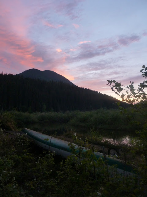
After picking up wood from a lot where Swan Lake bifurcates, we decided to head into a backwater on the northeastern end of the lake, and navigate to a cabin that was indicated on the Upper Bowron River. The route into the river was not obvious, and we had to backtrack once to get ourselves into the main channel. At one point we had to paddle up and over a small beaver dam; fortunately it was mostly submerged, and the boat's momentum carried us through. After a few hundred metres, we reached a point where the river, flowing in from the east, splits. We had arrived via one outflow channel, and were glad to now ride the current down the other until we arrived at the cabin. It's not obvious from the map that this cabin is actually tucked away perhaps a kilometre upstream from the Bowron Lake end of the channel, and I suspect that a lot of people give up on fighting the current, and don't make it to the cabin, certainly in spring when the water is relatively high. Anyway, we had yet another camp and cabin to ourselves. We were glad of the cabin; this is a pretty buggy spot, enclosed by marshland. I killed a lot of mosquitoes in the cabin that evening! The sky at sunset was beautiful, and we both slept well, but woke early.

Upper Bowron River and marshland. Bug Heaven...
>
Another idyllic campsite - and cabin - to ourselves.
Canoe at sunset.
Upper Bowron River reflections.
Day Six: Upper Bowron River Cabin to Trailhead
Awake around five, we fired up the stove in the cabin, because the night had been clear and cold. This had killed most of the bugs again. In fact, one of the most amazing things about this trip was that I only picked up about three or four mosquito bites in a whole week. Normally I'm a walking, bleeding pincushion for the little buggers!
Moody morning cloud.
We hit the water early, passing three fellow paddlers after twenty minutes. That put us at the front of the expected charge down Bowron Lake, and it meant that we saw plenty of wildlife, including a cow moose and calf that we surprised at very close quarters due to the wandering nature of the river channel. Fortunately, she took off away from the river rather than through it. After that, we saw a variety of birds, including eagles, pelicans, a sandhill crane, and an owl.
Heading down the still Bowron River.
Entering Bowron Lake.
Goodbye to the mountains.
There were no issues with waves on Bowron lake; it was a perfect mirror.
Pelicans take flight as we pass them.
Pelicans in flight over Bowron Lake.
The water was so still that we could see fish swimming far below the boat. We took our time on this final section, getting used to the sights of houses, and the noise of boat engines. This is the only lake on which powered craft are allowed, and it wasn't too long before we saw a compensatory twit throwing fast turns in a speedboat near the campground. There's always a moment toward the end of a trip when the sad reality of the world floods back in, and that was it for this one!
Summary
Overall, the trip took about five days of paddling, spread over six calendar days. The first two days were probably a little long given that we were not season-hardened at that stage, but it's worth remembering that at one extreme, the record is
13 hours, and at the other, your permit is valid for two weeks. Remember though, that the longer you travel for, the more stuff you need to carry!
Here are a few tips from my experience of paddling the Bowron Lakes:
- There is no cell coverage in Wells, or on the circuit. In Wells, however, there is wi-fi at the hotel bar.
- There was zero fresh produce available in Wells when we were there. maybe that improves in the summer; maybe not. Plan ahead.
- The technical difficulty of the trip is minimal, but it would be a good idea to understand basic river paddling techniques, and know how to manage a loaded boat before you go. That way you can enjoy The Chute, etc. and it won't be an ordeal.
- Take or hire a cart. Multiple-run portages add a lot of distance to the trip, because whereas a single portage might be 2 km long, returning to run a second load triples this distance rather than doubling it.
- When pushing the cart, slow down for potholes, roots ad rocks, and always have someone at the back end to prevent it from tipping over.
- May is nice and quiet, and the bugs might not even be hatching yet. It can also be a little chilly though.
- Don't count on sleeping in the cabins. In fact, given that they are all mouse-ridden, I wouldn't sleep in them at all unless I'd had a real calamity on the water.
- The wood in the woodlots is typically freshly cut, and needs splitting. Take a saw and a maul. A hatchet won't do you much good.
- Check the list of banned items. It includes beer cans, glass bottles, and tins.
- All sites have pit toilets. None of the toilets have loo roll or hand sanitizer. Go prepared!
- A deck on your canoe may help you to avoid swamping in large waves, but if you're not used to paddling in such conditions, you'll probably wish you'd put ashore long before the deck starts to be effective in saving you from Davy Jones's clutches. A deck will also keep you warm and dry, though.
- Don't miss the Caribou Falls hike!
Final shot of pelicans returning to their morning sunbathing spot, as we head down Bowron Lake.


