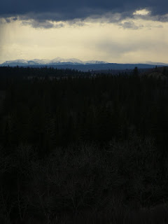
Looking west from South Baldy, Kananskis Country

Looking west from South Baldy, Kananskis Country

Saturday 23 May 2009

Paddling Through Calgary

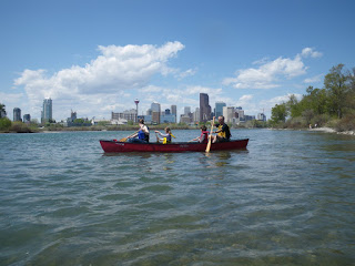
Lou, Jakob, Rachel and Frans in front of downtown CalgaryI suppose that being European makes me expect that all cities built on rivers will have evolved around the water, and so development will have made best use of waterfront space. Calgary is defintely not one of those cities, in fact it's hard to think of a location in the city where anyone has said 'hey, let's build a restaurant or pub that enjoys the view of the river'. Instead everything is motor-oriented and the waterways of the Bow, Elbow and Fish Creek are almost untouched by development. There are exceptions: former refineries where oil seeps from the riverbank, sewage works, and large houses with 'No Trespassing' signs shoved in your face, but generally, the rivers are (sic) a natural backwater that is best explored by canoe. Just pick a day when the 'tubers' have stayed home....

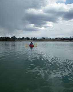
Today we paddled the Elbow River from a couple of km below the reservoir, into downtown, via the zoo (for ice cream) and thus on to highway 22X. That's around 29 km of paddling, which took four hours, including a half hour for lunch. What a fantastic paddle this is; it's never difficult or scary, and you'll probably see deer, coyote, pelicans and loads of other creatures.

Startled Pelicans near Fish Creek

Sunday 17 May 2009

Update on the ice breakup

An update on the breakup of ice on Alberta lakes, May 17.

Glenmore has been free for a couple of weeks now, but the latest from the Barrier Lake info centre is that Barrier Lake is still ice-bound in the centre, with open water around the shores. The Kananaskis Lakes are still solid, and Spray Lake 'looked like a glacier'. When is winter finally going to bugger off? It's five weeks until the longest day and only 12-15 weeks before people will be out scouting for early-season winter ice climbing again. We do seem to be suffering this year. The forecast for Monday in Calgary is around 4-6C and possible snow. Whoopee.....

Saturday 16 May 2009

Nine Hills Ride, South of Calgary

Just south of Calgary and highway 22X there is a wealth of great cycling to be had. Today, Lou and I did a nice 40 km circuit with some lovely smooth roads, several hills (about nine, maybe) and fantastic views of the mountains.

This is a great evening or morning ride. Our riding time was around 1.75 to 2 hours, but that was Lou's first outing on the hills for a very long time, and only my 3rd. The first 10 km is pleasant riding on gently undulating roads, through horse country. Turning south onto the main local highway, you get a great continuous run on a smooth asphalt and at 20 km you start to think it's in the bag. Then you turn west towards Millarville and almost immediately, the hills start. The third is probably the worst on this ride, and is horribly obvious from several km away. After a fourth and maybe a fifth, you turn north onto the Roller Coaster Ride (112th St) which is super-smooth, but has five hills, of which the second is the highest on the ride at about 1225 m elevation. Descending this I hit 71 kph; next time I might try for 80 if there's no traffic around. The reward at 36 km is a 3.5 km solid downhill, to the finish. Doing the ride in reverse would somehow make it harder I think, and you would lose the mountain views.

Thursday 14 May 2009

Fish Creek

Fish Creek and Moose Mountain May 13 2009Fish Creek is my local park in Calgary. It's about 10 miles long, and perhaps a mile wide at its greatest extent. Because it is situated at the bottom of steep-sided slopes, there is a definite feeling that you have stepped out of the city as soon as you enter the park, and the forest closes in. The creek flows from the Rockies to the southwest and serves as a wildlife corridor. Deer, coyote, bald eagles and osprey are fairly common in the park, plus the occasional sighting of bears, cougars and bobcats, which the City tries to relocate to the mountains whenever they are spotted. Visibility is often less than 20 m, so tracking animals down can be pretty difficult.

The park also houses cycle paths that link into the main network of pathways in the city - I can ride 20 km to work via this park and the Bow River parkway system, spending only 2 km on asphalt. On Christmas Eve I used the park to ski to work. I'm not sure I'll do that again for a while though; the snow was a combination of thigh-deep baseless powder over thick vegetation and skimmed, packed snow less than a cm thick on the cleared pathways. Neither made for great skiing.


Monday 11 May 2009

Eagle Lake, Strathmore

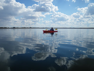
Paddling under a big skyEagle Lake, on the prairie 45 minutes east of Calgary is way harder to find and access than to paddle around. Opportunities to launch are severly curtailed, and the only good spot is occupied by a caravan park. In true caravanners' nature, this means that a kayaker wishing to launch is expected to pay $7 per boat. Fortunately there is a second access point, but directions on the web are garbled. It took us a long time and a lot of dirt road driving to find the launch spot. Take highway 817, then township road 232 east. The (gravel) road north to the lake is range road 245, but there is no sign to this effect. There is a tall, brown metal farm building close to this corner. If you can see Namaka Lake on the right then you have gone too far. The launch point is a few km up the road, where the road becomes a grass track, and finally ends. It doesn't look like a great put-in spot, and the mud really stinks, but it is possible to make it out without getting wet/mucky if you udge a little.

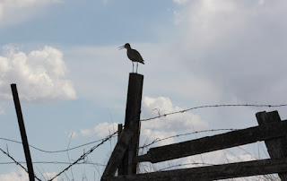
SandpiperIs it worth the hassle? Well, the ice thaws here when the mountains are still mantled with snow. Apart from the odd moron on a wet bike, you'll have the place to yourself, and this is a very popular spot for migrating birds. We saw birds here that we've not spotted elsewhere, and there is something satisfying about watching rain sweep in across the prairie, and hearing it pelt the rushes, as you watch the wildlife from your boat.

Black Crowned Night Heron

Saturday 9 May 2009

A Double Decker Day

Rob on Prairie MtnMy friend Rob Kinsey was staying with us again, at the end of his family holiday. Sofie and daughter Sennen headed to the zoo with Lou, so the boys were free to play, for one day only. We opted for a combination day - a hike up Prairie Mountain followed by a kayak trip on Glenmore Reservoir, then a barbeque and beers on the porch. How Canadian, eh?


If the bears don't kill you, the air probably will.

Our route up Prairie Mountain was a new one to me - I'd recently seen a couple of hikers take a ridge that branches off the Prairie Creek Trail about 1.5 km from the winter gate. This turned out to be an excellent way of reaching the summit ridge of Prairie Mountain. It's still pretty steep, but you get a view all the way up, and are unlikely to cross paths with anyone. I noticed a bad smell a few times - I put it down to Rob's guts and said nothing.

The summit ridge was covered in fresh snow, and low cloud made Moose Mountain look broody. On the last few steps I mentioned an alternative ridge that I'd noticed, which looked like a good scramble. Rob was up for descending it, so we headed down. To get to this ridge, you reverse the first 100 m or so of the summit path, then head left until you can see scree below you, and head for it. It gives a good view of the cornice on the summit ridge, which is actually quite a bit bigger than it appears from the normal route.

The rib turned out to be OK in descent, but wouldn't be much fun to climb up as there was a lot of scree. After a few minutes I could smell rotten eggs again. Rob was nowhere near me - so the other obvious conclusion (for an Albertan) was drawn - we were walking through an area of Hydrogen Sulphide (sour gas) seeps. There wasn't much we could do about it, and a decent breeze was blowing, so we tried to stick to the high ground, and got out of there, fast. The ridge eventually joins a pleasant creekside trail, which brings you to a junction with a well-worn trail after 15 minutes. The left fork then lands you on the road at the winter gate parking area. This made a nice variation on the usual Prairie Mountain routes, and took 2 hours 45 mins round trip.

Cold feetShopping By Kayak

Pelicans


I wanted to show Rob the beaver colony that we'd found on the Elbow River, but after an entertaining paddle through small waves and rain, we found that the water level on Glenmore Reservoir had dropped, and we couldn't get to the river channel. We spent 30 minutes trying, and at one point Rob even braved the cold to try to drag his boat to deeper water, but eventually we gave up. Seeing a flock of pelicans on the lake was a good compromise and so we continued, pLoading the shoppingaddling right around the reservoir. While we were near Heritage Park, Lou called me asking us to go to Safeway.....well, it's only a short walk if you beach the kayaks in the right spot, so I wandered around the supermarket in my kayak gear, getting funny looks and leaving a muddy trail behind me. At the checkout I was offered 'carry out assistance' - unfortunately it transpired that they didn't include loading shopping into kayaks in the service, so I had to decline.....

It's funny how a poor forecast will give you the hills and lakes to yourself out here: we saw three people on the summit ridge of Prairie Mountain, and two kayakers on the reservoir, right at the end. Definitely a good day out!

Update on The Ice Breakup

When does the ice break up around here for paddling? I couldn't find anything online to help me, so here's a record of how things have been in 2009.

Before May 1: No lakes clear in or west of Calgary. Bow River had cleared early in April.

May 3: Glenmore Reservoir was partially clear, but some icebreaking required to get between the south and north shores. Weaselhead Flats inaccessible. Ghost Reservoir still completely frozen, but looked like it might clear soon.

May 6: Glenmore Reservoir clear.

May 8: Phone call to warden in Barrier Lake info centre indicated that all of the local lakes (Spray, Barrier, K Lakes) are still frozen.

Monday 4 May 2009

Breaking the ice: Glenmore Reservoir

Lou paddles on the reservoirThe gentle lapping of water against the receding ice, hundreds of wild birds screeching all around us. A steam train hoots in the distance. Snowy mountains on the skyline; fish break the water ahead of my kayak, and a muskrat sits on a rotten log off my bow. So glad I moved to the Rockies and bought a kayak to paddle in the mountain lakes.

The distant sound of a tannoy playing music from a Wild West dancehall, a distant rumble of traffic. Ah, yes - open my eyes and this is central Calgary....

May 3rd and still we have no break-up on the lakes. It's been quite a hard winter, and fresh snow is still blanketing the nearby foothills frequently. We took our kayaks to Glenmore Reservoir, about 10 minutes' drive from our house. The ice hadn't cleared, but at least we could get out onto some water at last.

Muskrat
We followed another paddler out to the ice shelf and then through it, as he battered a path to the western side of the reservoir. Paddling in ice was a new and novel experience. Breaking through is fun so long as the boat stays level. Once you're past the blockage, the bow wave from your boat trails a swishing sound behind you as it lifts the ice. Peaceful.

Through the ice Lou had a good play with her new camera and got some great shots of birds in flight.

My underwater camera got its first dunking too - here's a half-submerged shot of the shore ice.

Underwater shot


A few more shots of paddling that day have been posted here.

Saturday 2 May 2009

When sixty-six was ninety-two.

Went out for my third road ride of the year yesterday with Simon, who is in training for an Iron Man triathlon. He selected a route from his house that heads out to Cochrane then does a quick loop past Big Hill Springs before returning. '66 km' he said - so I thought 'fine, one bottle of water, no food needed'. Big Mistake. We (I was there, so have to take some blame) missed a turning (which I wasn't aware we were looking for) northwest of Cochrane and ended up waaaaay north of our intended route. This then meant returning up the big hill out of Cochrane, which started at 72 km on the odometer (and ended at 75.5 km). Total distance: 92 km, averaging somewhere over 26 km/h. Man, my legs and backside were aching afterwards! Two things of interest happened during the ride: I met a guy from Wednesfield, England (not many of us ex-Wulfrunians out here), and I noticed the sparkling azure of the Ghost Reservoir in the distance so could plan the next day's kayak trip. Another mistake in the making....