Mount Fable and Gap Peak
I first saw Mt. Fable and Gable Ridge several years ago; perhaps from the Barrier Fire Lookout. I remember regarding Fable’s seemingly impregnable pyramid and tangle of knife-edge ridges, and thinking “I’ll never try that one – it looks difficult and terrifying.”Somehow though, it became a bit of must-do peak, as part of my “skyline quest” – the general mission to ascend all of the major scrambling peaks between the Highwood Pass and Banff, plus any that you can see from Calgary. After several previous non-committal, aborted plans to try it, yesterday Tristan and I headed to Exshaw. We were still in denial; we planned to summit Fable, but were not really entertaining the idea of attempting the “Gable” ridge that joins it to Gap Peak. Therefore we made no plans for leaving a bike or second vehicle near Grotto Canyon. Still, what’s so bad about a 4 km road walk in the rain on a Sunday night?
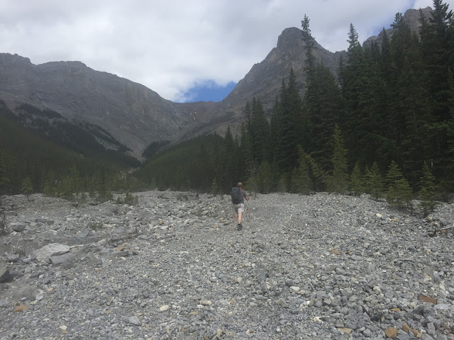
The approach to Fable covered approximately 8 km of flood-damaged canyon floor. It started off easily enough; from the footbridge by some large blue bins (the correct parking place to avoid annoying the local residents) a rough trail avoided the Lafarge property, depositing us at the old dam. After that the going was a little tedious, but not difficult. There was no clear trail; we just boulder-hopped and criss-crossed the creek with occasional detours to avoid logjams.
Mt. Fable looks a long way off when you start. After an hour, it did not appear to be any closer, but it did look a lot bigger - huge, in fact. Kane’s book suggests that the necessary branch valley is reached in an hour; we took twenty minutes longer, which had me wondering whether we were well off our usual pace. We pushed on; the angle soon increased and the going got rougher.
The objective is to circumvent the mountain’s south face and gain the west ridge via a scree slope. It’s 1,325 m vertical from the car; most of this happens after you enter the branch valley. The going got progressively less pleasant; at first the ground just became rougher, but soon we were clambering over boulders, and cursing treadmill scree diversions up the sidewalls.
After about 7 km we reached a narrowing where a landslide had choked the canyon. At this point the angle increased again, and soon we were scrambling over rock steps while the scree slope to the ridge unfolded ahead of us. The scree itself was pretty disgusting. There was a party of four scramblers behind us, one of whom took Kane’s suggested gully scramble off to the right. He made good progress, but set off some rattling rockfalls that suggested the gully was not a good place for groups.
It really did feel like a long way to the ridge; I thought this ascent was harder work than Middle Sister, which I’d scrambled the weekend previous. From a col on the ridge, the summit cone still looked a long way above us.
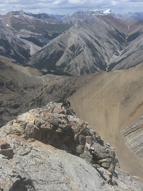
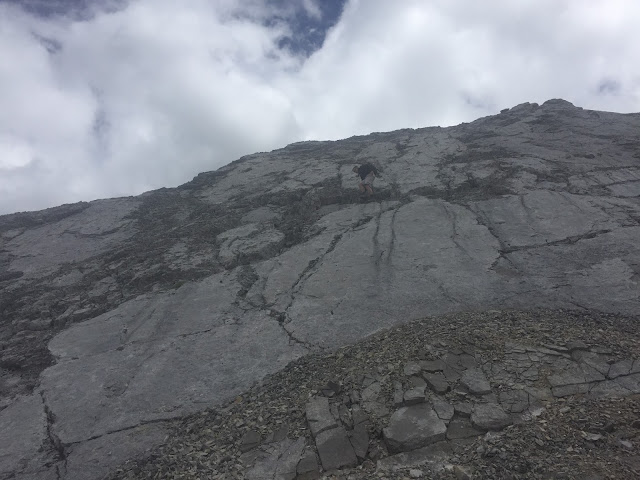
The scrambling got a little harder and more exposed immediately after the col. First there was a cluster of gendarmes. Some were easily climbed over, but at least one required a small detour back down to the right before it could be passed. Then came a slabby section where the friction was superb, but falling off would not be enjoyable. After that, the ridge became a little more defined, and alternated between solid slabby sections and loose scree over rock. It wasn’t difficult though, and we made good progress to Fable’s distinctive summit with its cross.
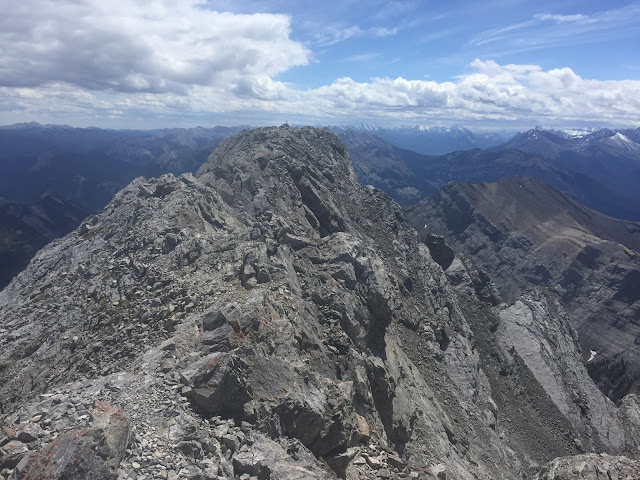
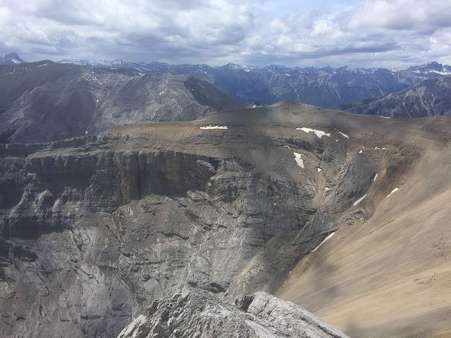
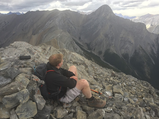
It had been sunny all morning, but looking south towards where Mt. Assiniboine should have been visible, the sky had darkened. No rain was forecast, so we were not concerned, and the skies nearby stayed mostly blue. At this point we had a good view of the Gable Ridge. There were two places where it looked sketchy: a section that appeared to be a tilted bedding plane creating a knife-edge, and the final approach to gap Peak. We still didn’t have a firm plan, but the approach had been unpleasant enough that we thought another way off might make a pleasant alternative.
At this stage, the vague wording of Kane’s book was causing me some concern. Usually his route timings are presented as a range. For Mount Fable this meant 6-9 hours. By my reckoning, despite the oddity with the south fork turning, we were running perhaps 15 minutes behind the six hour mark, allowing for a rapid descent on running scree below the col. The next part of his description for Gable Ridge just said “11 hours”. So was that 11 hours at six-hour pace, or at nine-hour? If it's for six-hour, then you need to be on your game, otherwise you're looking at nine hours plus eleven minus six, which is 14 hours. That's a long day...
Another issue was his side-stepping assigning a grade to the ridge. Instead of the usual choice of easy-moderate-difficult, the book merely said “this is not a difficult scramble”, almost as if countering an argument made by other scramblers’ accounts. Misgivings were brewing like the dark clouds that were now enveloping Mt. Lougheed.
We decided to descend to the col and have a think about continuing versus descending. It looked as if the first section of the ridge was pretty much a walk, so we could always have a look and come back...
Well, of course, we carried right on up the ridge without pause. After a couple of small climbs and drops we reached a place where some hands-on work was required. Beyond that the going was easier, and we were soon on the main ridge heading towards Gap Peak.
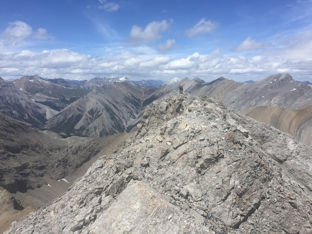
After perhaps a kilometre, the ridge split into two. A mountaineering traverse to Grotto headed right, and along the left branch our route became a super-easy highway in the sky. It was at this moment that we heard distant thunder. We hurried on; two lonely lightning rods on the skyline. Below us, the other scramblers disappeared towards Exshaw, and we were alone. It was now around 330 PM.
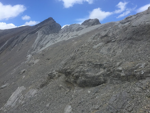
One odd thing about this route is that we did not see a cairn anywhere – you can’t rely on a clear path or markers. Although you are following the ridge, once the first rock steps arrive there is plenty of leeway for making the wrong choice. We dropped down a series of small steps. What had appeared from Fable to be a major obstacle, actually provided some fabulous slabby sections. These were the best part of the scramble in my opinion, but would have been horrible in rain, snow or ice.
We were relieved to find that the hard-looking bare section of the ridge was bypassed by a lower trail on the right, and at this stage the route down into Grotto Canyon looked simple, if we needed to escape. After this we passed two towers. The second had looked problematic, but a simple, level path threaded along its east face above the cliffs. Beyond this final tower we wandered through a slate garden that bristled with fissile rocky spines, and then we found ourselves approaching Gap Peak.
At Gap Peak, the guidebook’s vague wording stopped us in our tracks. The ridge narrowed to boot-width, then started to climb sharply. In my perception, the grade of the scramble climbed at a similar trajectory. The first part looked like an exposed “moderate”, but as the narrow, bare fin climbed towards the summit, it became like nothing that I’d ever seen at that grade.
We crossed the initial, level blade, and then stopped for a reappraisal. From our ledge above Grotto Canyon we could see a sheep track that approached us before disappearing behind a loose ridge and snow-filled chimney. From that track, it looked as if the summit might be gained via scree slopes. We decided to take a look, and found the going straightforward. Ten minutes later we were on top of Gap Peak!
It was now 5 PM, and the weather that had been advancing from southern K Country was doing its best to cross the Trans Canada Trail. Lac des Arcs had been whipped into cafe latte, which was a sure sign of high winds in the valley. We quickly considered our options. There was a clear trail inviting us to head southeast towards the car, but Kane warned against it. Similarly, the valley below us was vetoed (I think it ends at Grotto Falls). We followed his suggested route over some bumps to the southwest. The wind increased steadily, and it began to spit with rain. After several bumps we could see a path that dropped off to our right and vanished into a long scree slope. With the threat of lightning on my mind, I jumped onto this, and rode it down for several hundred metres.
Had I stopped to look at the guidebook, I’d have seen that the suggested route went left from that ridge, rather than right.
We continued to descend. The scree gave way to more solid rubble, and then trees, as the drainage gradually closed in. Soon we were in a defined canyon. We met a small rock step about three metres high. It was undercut, but there was a prominent, provident jug on the lip, and we were able to lower ourselves. At this point we still believed that we were on the recommended descent route. If this section had been wet, we’d probably have been trapped below it, but for now the rock was dry, and the friction good enough to allow us to re-climb it, if sufficiently desperate.
After descending further easier rock steps, we reached a horizon line within a tightly-walled rocky enclave. I lowered myself down to a ledge, and looked down. We were on a cliff band. Below me, the creek bed dropped in two vertical steps, then launched into a waterfall perhaps 15-20 m high. Fortunately, it was dry, although the clouds were now blocking our view of Grotto Mountain. What they did allow, however, was a view of the cliffs opposite, which rose 200 m before disappearing. It seemed likely that the same cliffs extended to our side of the valley, and that we were now somewhere in the middle of them.
Looking down, I could see a grassy ledge that disappeared to my left. There was a superb, deep crack in the back of the waterfall at this point, and I used it to lower myself onto the ledge at the lip of the main fall. From here, it was possible to walk sideways and gain a forested slope above more cliffs. We scouted along the slope, avoiding places where the ground had collapsed, and was hanging out in space below. Soon, a mossy ramp led down and around the waterfall cliff.
After a hundred metres, we found ourselves back in the gully. Around this point I remember thinking that neither my phone nor my SPOT rescue transponder would be likely to work; the gully was too tightly walled. We followed it down, and down, climbing and sliding down several additional steps, constantly expecting to meet a stopper cliff with no exit. A friend of mind had been benighted on the descent from Gap recently; I wondered whether this was the same gully. To escape would require regaining almost 1,000 m of height, before trying to find another route down in failing light. I questioned whether anyone had been this way before. Certainly there had been signs of passage in the scree high-up, and in a couple of places I’d noticed rocks sitting in unnatural places, as if they’d been moved to assist people climbing down the waterfall steps.
Eventually, probably an hour after we entered the gully, it spat us out into Grotto Canyon. Although this was a great relief, I’d never been this far up the canyon, and was still concerned that there could be another cliff below us. I set about searching the canyon floor, and almost immediately turned up a discarded picnic bag. Normally I hate finding litter, but on this occasion it was reassuring to know that picnickers had made it this far!
Soon after this, a rainbow appeared in the valley ahead.
We stumbled down the canyon. I’d forgotten just how far it is from the slab climbing area to Grotto Falls, and of course the floor was a mess of post-flood debris. Gradually a path emerged, and we made good time to the canyon mouth, where we collapsed on a bench, and updated our partners on our ETA home. All that remained was a 4 km trudge along the road, in the rain.
Looking back, it’s not a trip that I am in a hurry to repeat. I’ve since read a few accounts of people tackling this traverse in the other direction. That would make sense; you can take a more direct scrambling route up Gap Peak, and descend the scree grind from Fable. Posted times in that direction tend to be about 8-9 hours, whereas the few accounts I’ve found for Fable-Gap are 10-12, without the 4 km road return. We took 11 hours and ten minutes, car to car. Our descent route would make an interesting line for an adventurous party; if you ignore the uncertainty of escape then the gully scrambling was generally fun, but if it had been at all wet, we'd probably have been in the local news last night.
Details
Fable to Gap Traverse via Gable Ridge.
Distance: 26.1 km car to car.
Total Ascent: 2,000 m (I based this on Parry Loeffler’s table, which said 1,960 m, then added 40 m for the road section. By then you'll be well past caring).
Time: 11 hours and ten minutes.
Grade: Moderate if you avoid the upper ridge to Gap Peak.














No comments:
Post a Comment