 Here is a picture (left) of Paul Warman descending the log jam in Hood Creek (Kananaskis Country). What a day! We had gone to climb Waxy Referendum (WI3, 100 m), but the guidebook really bummed out on its description of the approach. The cited approach time is 90 minutes; after 5 hours of hiking in fairly light snow conditions we turned around. The guidebook writer had cryptically suggested that approaching this climb via Hood Creek was a bad idea. After five hours of toil for no result, the route came into sight maybe 30 minutes above us, but the light was already failing. At this point we decided that this book really couldn't be trusted! Ninety minutes of descent later, we hit a 20 m high jam comprising thousands of logs wedged into a narrow canyon, and had to abseil down, avoiding pools at the bottom. So now we know why Hood Creek is a bad idea - but not why the FA forgot how long the approach took!
Looking west from South Baldy, Kananskis Country

Site Pages - Info and Maps
Saturday, 20 December 2008
Waxy Referendum - the climb that never was
 Here is a picture (left) of Paul Warman descending the log jam in Hood Creek (Kananaskis Country). What a day! We had gone to climb Waxy Referendum (WI3, 100 m), but the guidebook really bummed out on its description of the approach. The cited approach time is 90 minutes; after 5 hours of hiking in fairly light snow conditions we turned around. The guidebook writer had cryptically suggested that approaching this climb via Hood Creek was a bad idea. After five hours of toil for no result, the route came into sight maybe 30 minutes above us, but the light was already failing. At this point we decided that this book really couldn't be trusted! Ninety minutes of descent later, we hit a 20 m high jam comprising thousands of logs wedged into a narrow canyon, and had to abseil down, avoiding pools at the bottom. So now we know why Hood Creek is a bad idea - but not why the FA forgot how long the approach took!
Saturday, 20 September 2008
Climbing in the South Ghost River Valley
 The Ghost River Valley is about 90 minutes from Calgary, accessed via a gravel road and then a section of road that requires a 4 x 4. Despite being close to Calgary and Cochrane, it's a remote place to climb and help is a long way away if you get in trouble. There are many kilometres of cliff here, and probably untold unclimbed lines - but the rock is steep and often loose, so the sitaution is unlikely to change.
Here are some pictures from a rock climbing trip into the Ghost that I made with Grant, local access worker and Ghost afficionado. I found the climbing tough - I'm still not used to the YDS grading, but it seems to me that if the rock is loose and the protection dubious, then the tech grade within the overall grade calculation should slide....this doesn't happen here though. Until I get my head around this one, I'm not leading much trad rock here!

Sunday, 14 September 2008
Ucluelet, Vancouver Island
 Our summer holiday in 2008 was a trip to Vancouver Island, staying in Victoria and Ucluelet. It was a fantastic place to visit, marred only by the people on the campsite and poor management of the site itself. Why fly and drive all the way to Ucluelet to sit outside your tent, making a racket, never leaving the site except to shop, and strewing your food and rubbish around, attracting bears? I really can't get to grips with this concept; even from the tent we watched otters, eagles and bears foraging the far shore, yet the people camped around us never even turned their heads towards the sea. We left the site early as we got fed up with the situation - two young, hungry bears had come into the area, attracted by food that people were leaving out overnight. Eventually, when it was looking inevitable that the bears would be shot, we headed south a day early. I wouldn't recommend the Ucluelet campsite to anybody until they sort out their wildlife management policy and start cracking down on some of the idiots that stay there. Unfortunately it's not in a national park, so the only recourse for complaint was the RCMP.
Saturday, 30 August 2008
Tofino Sea Kayak
 Near the end of our holiday in Ucluelet we booked onto a guided sea kayak trip. This was a group outing, with five clients and one instructor - by coincidence all of the clients were British.
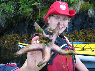
  We headed out into Clayoquot Sound and paddled towards the distant mountains of Strathcona Park. We didn't see any big wildlife (just one seal) but there were loads of birds, including nesting bald eagles with a juvenile, and the biggest starfish I've ever seen - almost a metre across! The trip was awesome and it's definitely something I'd like to go back and do more of.
 Friday, 15 August 2008
Sea Bears!
 If you want to see bears close up without disturbing them, booking onto a bear spotting boat trip is a good way to do it. These pictures were taken on a guided Zodiac tour of the coast around Ucleulet.
Sunday, 27 July 2008
Kayaking on Barrier Lake
 After a trip to Waterton Lakes where the rental rate for a canoe was extortionate, Lou and I decided to buy recreational/touring kayaks so that we could drift around the Rockies lakes. Here are some pictures from our first outing, on Barrier Lake (actually a reservoir), in Kananaskis Country. This is about 75 mins drive from home.
Kayaking on Lower Kananaskis Lake & Climbing on Cowbell Crag.
 Tim Capon came out to visit us from London, and we headed off for a long weekend's camping in Kananaskis Country. We had reservations about camping near Calgary - we'd heard too many horror stories about loud, all-night drinking parties at Bow Valley sites (why can't people who want to actively destroy the natural environment for the weekend just stay at home? Different country, same attitude...). In the event, the Canyon campsite in K Country turned out to be quiet, well run and a great place to stay - but get there early.
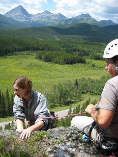
 We took the boats out twice on Lower Kananaskis Lake, which is set in a spectacular location. On Sunday we hiked up the Indefatigueable Trail, which overlooks Lower K Lake. We were then joined by Alex and Kathryn from Calgary, and headed south to climb on Cowbell Crag, an unusual trad venue formed from a tilted plane of conglomerate. A rope of five made for an interesting outing up a long pitch of 5.6, but it turned out to be a good route, under the encroaching dirt and vegetation.
More pics from this trip here.
Sunday, 13 July 2008
Crypt Lake, Waterton Lakes National Park, Alberta
 This hike is probably the most famous in the Waterton Lakes park, featuring a lake crossing, several waterfalls, a ford, a tunnel and exposed wire traverse. Swimming in Crypt Lake is optional! It gets busy in a limited way: the first stage of the trip is to pay the ferryman. That limits numbers on the trail to however many hikers fit on the boat from Waterton Townsite.
Once on the shore, people string out along the trail gradually. To avoid this, take the right-hand fork after a few hundred metres and approach Crypt Lake Trail via Hell Roaring Falls instead. I think this is a nicer way of doing things anyway, as Hell Roaring is nowhere near as spectacular as the Crypt Falls, so this way you avoid an anticlimax. Appearing in this album: Jeroen, Joe, Lou, Nikki, Tristan and Vicki.

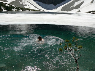
Incidentally, Crypt Falls goes at about WI4 in winter....if you can get there. For a taste of winter...go for a dip! I have never swum in such cold water.
Summit Lake Hike, Waterton Lakes
 Summit Lake, in Waterton Lakes National Park, is a fine little hike that gives great views south into Glacier National Park, USA. There's a great linear walk that continues from here down to Upper Waterton Lake, over 24 km. We just hiked the short trail to Summit Lake though. We saw no bears on this walk, but did spot three in a nearby valley, when we were driving around. they were being shooed up the hill by a guy - we thought perhaps they'd got too close to the campsite.
 It was on this trip that we decided to buy kayaks. There was a canoe rental outfit on the shore, charging something like $30 per 30 mins and $10 per swapped paddler. A quick sum showed that we'd get that money back very quickly if we just bought some boats.....it's easy to convince yourself on a hot mountain lakeside day!
Monday, 30 June 2008
Moose Mountain, May 2008, June 2008
 From Calgary, Moose Mountain is one of the most easily recognised mountains on the skyline. It's also the closest Rocky, at about 45 km from downtown. At 7,995 ft you're right on the cusp of what might be considered a 'real mountain'. Stand on the fire lookout's helipad and you're probably just about there!
We tried Moose Mtn twice in 2008. The first trip was a little early. We post-holed for 2-3 km before giving up; it turned out that another 100 metres would probably have got us out of the woods and onto a snow-free meadow.....and we missed the chance to be the first that year to sign the summit book. We only realised this when we returned in June, when the hike was straightforward.
Most books just describe the out-and-back trail that starts high on the mountain from a gas plant road, but a look at the map shows that there are several interesting variations that might be undertaken by hike-and-bike, or on a slightly convoluted circuit.
Saturday, 21 June 2008
Picasa Web Albums - Joe - Barrier Lake Fire Lookout, June 2008
 Barrier Lake Fire Lookout is great little hike. Done as a circuit via Jewel Creek and Jewel Falls it combines great views with pleasant hiking, and many wild flowers along the path. The trail is quite steep shortly before reaching a viewpoint just shy of the fire lookout, but the descent is gentle enough. Watch out for mountain bikers when you descend - the trail is narrow and visibility is poor.
Sunday, 15 June 2008
Nihahi Ridge, South Summit
 Nihahi Ridge is visible from many parts of Calgary. It is around 8,000 feet high and 7 km in length, and makes a popular target for local hikers, although many turn around shy of the first scramble section before the ridge proper, and only a very few continue past the south summit, leaving about 6.5 km of ridge untouched. Comparisons might be drawn with Crib Goch, Carn Mor Dearg arete, or Striding Edge, but it's really something else again, being the top of a bare, tilted slab of limestone with great views of the Front Ranges - spectacular, long, perhaps lacking the damp, rugged, charm of the British mountains, but for a local hike (40 minutes from our doorstep), you can't complain! The ridge is accessed via lovely meadows, which carry you up to a hillside of loose shale, and a final escape from the treeline. The path gets braided here; all routes lead upwards, with varying degrees of looseness and exposure. Soon the paths merge, and the first scramble section is reached.
 This really is a one-move wonder - 5 m of steeper ground, climbing a crack/groove on decent holds. The only issue is the slimy seep of groundwater that may be flowing down it.
Beyond the scramble, a pleasant path follows the ridge to a second scramble section. This is a nice, blocky corner with a crack in the back. It's a little exposed, but very short and secure. You land on the ridge, along which 500 m of walking with occasional hand and bottom assistance on the narrower parts takes you to the South Summit.
We only walked to the south summit on this occasion, but the full ridge beckons this summer. Some pics from our hike are here, and an account of the full ridge traverse is posted here
Saturday, 14 June 2008
Prairie Mountain
 Prairie Mountain is one of the closest hills to Calgary. As a consequence, it gets very popular on any warm weekend of the year. We had just purchased Gillean Daffern's book on local, generally low-level hikes, and this was one of the first hills we walked up. The trail is steep right from the outset, and although the height gain is just 700 m, this is done in a short distance, so the views open up pretty quickly. Although perhaps not as spectacular as the vista from the nearby, higher, Moose Mountain, at least when you climb Prairie Mountain by its main route from Highway 66, you don't feel like you cheated when you reach the summit! Here you can see great snow-capped block of Mt Romulus, behind Nihahi Ridge.
Subscribe to:
Comments (Atom)


