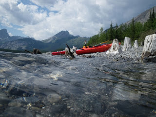
Looking west from South Baldy, Kananskis Country

Looking west from South Baldy, Kananskis Country

Saturday, 1 May 2010

New Boat!

I took the plunge last weekend and bought a new boat. Here she is:

16 3/4 feet of whitewater tripping canoe. We went for a spin on the river straightaway. We were pretty clueless really, but it was fun. Then we got home and realised that we had nowhere to keep it.....

Wednesday, 14 April 2010

Mount Royal Sprint Triathlon

Hamish aproaching transitionThis was the day when all those months of training that I'd planned over many pints of beer this winter were finally crystalised as palpable nonsense. Despite that, our team (Blake, who had done two training runs...on the same day, myself - more prepared at four swims before I hurt my back walking home from the pub - and Hamish, who is always willing to tell you how old he is....and he is!) managed to come in second in the team event. The aim was to finish, but we were secretly a little aggrieved to find that we were second by 17 seconds, but 7 minutes ahead of 3rd place.Blake running it home.  Go Blakey!

Saturday, 27 March 2010

Entrance Ridges, Kananaskis Country

Early view towards Bluerock Mtn area Oh, Mike Potter. The hiking author who goes where others decline to tread. I remember a conversation overheard by old school friend Dan Malcolm, back in England. Paraphrased, it went something like, 'Oh, hey have you been hiking?'.
'Yeah'.
'Cool, we did the Langdale Round. It was awesome'.
'Well I [blows out chest] went Ridge Walking'

It appears that Ridge Walking is indeed a sport apart. I hadn't learned my lesson from following Potter's debatably pleasurable route on Hell's Ridge last year, although the unmoving body on the other side of the bed this morning indicated that my wife clearly had no such problem. So Jason Bazinet and I headed to Starbuck's, from where, fortified by Cherry Mocha (weird stuff), we hit K Country.

Jason ponders the possibilities of cougars in the woodsI probably shouldn't describe the route, in case someone wants to go do it. Well maybe it's not such a bad hike really, although the views are pretty sparse, even with the trees still stripped for winter. We saw a couple of bald eagles - from the car, near my house -plus a mouse, a squirrel, and a lot of moose shit. And elk shit. And horse shit. And cow shit. The first section is OK once you find the route from the car (ignore the guidebook and start from the K Country sign, bearing right up the embankment behind it on a well defined path). After that you give up all your height, possibly terminally if the path is icy, and then regain it. Then you get a view, before the forest swallows you whole.
There is path through there.  Mike says so.
The first ridge is forested, but more of a woodland wander than a ridge walk. The descent to the saddle is rather more woody, in that twigs-down-your-neck way that this part of the Rockies specialises in.

The return is more pleasant, other than a nasty-looking bog which extends for about 300 m, but was, fortunately, still frozen. At this point we gave up on the official trail and took a cut through the corner of the neighbouring ranch (possible without climbing fences). The hike is about 8 km and takes around 3 hours, including route finding and bushwhacking. Banded/Glasgow Group

Wednesday, 24 March 2010

Spring Skiing

Someone told me about spring skiing shortly after I arrived. "Yeah man, it's really awesome, like, y'know, you ski in a T shirt".

Well I wore a T shirt last week. And a fleece. And a down vest. And a shell. And I was still bloody freezing.

The skiing was great though. Here's Lou descending Wild Side (Sunshine) in fresh snow. More pictures here.

Tuesday, 23 March 2010

Frank's Third Winter Visit

Matt Forshaw leads Slurpee, WI4+Frank Wigley made it over again for a week this winter; his third trip to see us in Canada. Th conditions were a little iffy, so instead of just ice climbing, we scrambled Baldy, climbed Slurpee, climbed rock at Wasootch, and skiied at Sunshine. We had a pretty decent week, and Frank even got a decent war wound to make his son proud, and his wife despair. Frank managing to not fall off Baldy

Saturday, 20 March 2010

Frank's Visit: Day 1. Baldy Mountain.

Frank Wigley scrambling on Baldy, Kananaskis CountryBaldy had been on my list of early season objectives for a couple of years. I think I'd never got around to it because it seemed pretty minor, but it turned out to be really good fun. It was Frank's first day of his third winter trip to the Rockies, and a great start to the trip. The first 45 minutes is a steep run up to the scrambling step, which is furnished with good holds, although some of them are spares, likes sharks' teeth. The guidebook time is 3-5 hours. I think we were round in about 3.5, without pushing too hard.

More pictures here.


Monday, 15 February 2010

A Bit of Everything

Seeps in Heart Creek, AlbertaSometimes you've just got to climb whatever's available. Back home, that meant greasy wet rock or dishwater-grey ice and wet snow. Today, we had something rather better, and were probably the only people out capitalising on the Other Summer of Rockies rock climbing.

Matthew Forshaw on the right-hand seep WI2+ 45 mIt was my first trip into Heart Creek, just 45 minutes west of Calgary. The main falls are somewhere beyond a narrow canyon, inaccesible today due to the recent 'warm temperatures'. Sadly it wasn't quite warm enough to make the creek pleasant to wade. This wasn't a problem though - there are some nice little seeps below the canyon. The larger is 45 m high, and I guess a stiff WI2 if taken direct. There's a lower-off chain up there too, but below it is a lottery of boulders, and it's best avoided for the manky tat to the left.

Slip slidin' awayMatthew ForshawMonkeyAfter a couple of laps, rounded off with green tea and a quick Twix fix, we admired the slabs, which are a prime summer climbing area. The old 'Other Summer' habits surfaced again....and in a few minutes we were trying one of the lines in big boots, armed with makeshift quickdraws. The belayer got crampons, allowing a sharp exit, but the leader got verglas and snow underfoot - on polished limestone. This didn't get us very far - Matthew took a couple of amusing unroped slides down the cliff and across the creek, but couldn't progress past the first bolt. Bring on the tape! Sticky tape saved the day and we soon had a clip stick fashioned from hiking poles. Riding on a neon cloud of coiffed peculiarity, Matthew levitated to the lower-off, clip stick hooked to his waist. With the rope up, and some finger-solidifying cleaning of holds completed, we had ourselves a nice route to play on. Passers-by found the event mystifying, but that's probably par for the course.At the lower-off, with ice seeps in background We don't know what we're doing half the time either.....

Saturday, 30 January 2010

Chantilly Falls

Jane Terry easing into her first ice climbAnother early season outing, late in the season. The weather here is still pretty mild, and with my week's skiing tally at two sessions already thanks to CADS, I headed to Evan Thomas Creek in K Country with Matthew and Jane. Jane had never climbed ice before. Jane had a close call on the approach, just like Ian the week before - slippery stuff, that ice....I need to start remembering what it's like to be climbing it for the first time again; after a while you forget that it's an alien feeling to balance on crampons on a 30-40 degree slope. After that little moment, we had a great time; the route is in odd, but good condition, and even better, we didn't get ambushed by cougars on the way out. A great day on all fronts.

More pictures here.

Monday, 25 January 2010

A late start to the season

Ha Ling behind our little ice lineAlmost the end of January, and I've finally managed to get out climbing. I headed to the Junkyards in Canmore for a warm-up day with Ian Stewart, who I've biked and hiked with over the past few months. We had a great day out and I climbed a new line that I'd seen previously, up in the east of the Junkyards.
The ice was really fat, the air wasn't too cold (-10C maybe) and we saw Grant at the crag (Hi Grant!), Ian Stewart topping outso it was a pretty good day out, all in all. More pics here.

Saturday, 23 January 2010

A spot of lunch in Jasper

With my wife a bit under the weather I didn't want to be away from home, but I had a commitment to meet a client in Jasper to kick off a project there. So I decided to drive the 900+ km round trip in a day, and keep everyone happy. I've driven the Icefields Parkway a few times, and cycled from Jasper to Banff last summer, but never driven it in winter before. Matt Forshaw joined me, as he wanted to spot a few climbing objectives on the Parkway. The trip went really well, although the whole day out was 16 hours, and I didn't sleep much the night before due to the cats deciding to play games on top of me all night. I posted a few pictures of the trip here.

Sunday, 10 January 2010

Mainly urban skiing

Canada Olympic Park in December 2010I've not been updating this blog much so far over the winter. It's mainly due to a lack of trips to the hills. Through Mark (with whom I climbed Mt Rae) I got involved with CADS, the disabled ski association, so since early November I've been attending Thursday training sessions and helping out on Friday ski nights, at Canada Olympic Park in Calgary. It's done my skiing a lot of good; although I've had less trips to the mountains, I've had maybe a dozen trips to COP. Having to think about how to help someone less physically able to ski safely really improves your balance.

Looking out at Calgary across the COP slopes
On the few trips to the mountains we've had so far this season, I've been getting a lot of skiing into a short time; last Sunday I descended 72 km and 9,700 m at Sunshine Village, with the majority being off-piste and gladed skiing. It's a far cry from a few years back, when I could barely ski at all. I wasn't planning on skiing much this season, but as usual, plans change. This is, after all, what they call 'adaptive skiing'!


Wednesday, 23 December 2009

2009: A sparse rock year!

Well, it's December and I have just managed to get in my second day of proper rock climbing of the year - in England. Hopefully I'll get more done next year. Here's a picture of us out in the snow at Froggatt Edge.

Monday, 9 November 2009

Mt. Glasgow northern spur attempt

On Saturday myself and Matt Forshaw had a wander up a spur that extends off Mt Glasgow. Conditions were pretty foul, but it was good to be out in the snow, and off the trail. Our objective was the central ridge and summit in this photo, taken in warmer times from Forgetmenot Lake. There is no recognised trail up this ridge, although Tony Daffearn described a scramble on it earlier in 2009.
From the Elbow trailhead we crossed the suspension bridge then turned right. After 2.5 km we followed Glasgow Creek, staying on the right (west) of the creek. About 1.5 km after leaving the river, we reached a creek junction joining from a major valley to the west. This is the second drainage off the Glasgow massif, and not Glasgow Creek, which is the third. We then thrashed up the treed ridge-end to the SW, skirting a rock outcrop at the top by heading left. This was quite steep at the top and in places the powder was thigh-deep.
Once we hit the ridge conditions were miserable, but the crust was often strong enough to support our weight, and we followed the crest for several hundred metres, avoiding a cornice on the north side. Eventually we reached a knoll, visible as a flattening of the ridge in the photo above, prior to the knife edge section that stretches about 1 km to the summit at 9,300 ft. At this point we decided that the conditions merited a return to the pub, so we dropped down to the south, picking up Glasgow Creek. There was one minor cliff band to negotiate, but it was OK via a snow-filled gully. There was some impressive 'future generation' hanging ice on the opposite valley wall. Had we continued up the ridge far enough, we would have reached Mt. Glasgow, via the rather scary-looking route visible on the far right of this photo.

As it was, we descended fairly quickly despite deeper snow, passing the odd cairn and a lot of wolf tracks. For fun, we decided to wade the Little Elbow to finish off the day. It was good practice for ice climbing in the Ghost....or something. All in all we had a good day out despite the weather and I'd love to return and look further up the ridge to see what might be possible in better conditions.

Saturday, 31 October 2009

Moose Mountain, Halloween 2009

The Moose Mountain road closes for several months each winter, but not before you get the chance to hike up there in the snow. I headed up with Keith, a friend from work. It was his first trip to the hills in winter, and I think it opened up new horizons. The weather was pretty foul due to high winds and spindrift, but the views were still special.

Tuesday, 20 October 2009

Elkhorn Slough Kayak, California

Sea lions on the pier in Elkhorn SloughThis was a really great little paddle snatched while we were down in Santa Cruz. I recommend it as an easy day out with plenty of wildlife, including many sea lions and sea otters. If you are happy handling a sea kayak in calm waters then this is a gem of a day out, so close to the city. It was a great recommendation - thanks Nigel!. We had sea otters climbing onto the ends of of boats after drifting quietly for a while - they are amazing creatures. I have posted an account of the day on my photo site.

Friday, 16 October 2009

Bike the Bay, San Franciso

I didn't get too excited about San Francisco really. It's a big, crowded city, very expensive, and plagued with fog. Although I'm in no rush to return, our bike ride around the bay and over the Golden Gate Bridge was a nice day out, and worth doing if you are in town. I posted a few pics from that excursion here.

Thursday, 15 October 2009

Yosemite - a bit of a mess really

Half Dome at sunset Lou and I took a week down in California for a friend's wedding during September. We soon got bored of the city, and headed inland to check out Yosemite. The area is great for hiking and climbing, but the American park authorities seem to have lost the plot, unfortunately: the place is overrun with gawpers in buses, and commercial tat where there should be a beautiful, quiet and spectacular valley. We found it easy enough to escape the crowds (tip: use those things that hang off your hips to walk more than 500 m away from the visitors' centre), and we did a great hike up to the rim of the valley, but the place was a bit of an embarrassment considering the pious lecturing you see in the press about how the US Government is so proud of its parks.

The solution looks to be simple enough: demolish the visitors' village, move the entire mess back several miles to where a distant view of Half Dome is still available to the Nikon-waving throngs, and make the valley floor inaccessable to petrol engines. Set up a proper bicyle rental centre aimed to encourage people to ride into the park, instead of the eye-watering rip-off and limited availability of bikes presently available, and rent out cycle trailers for small children to ride in. Those too lazy to walk or cycle could still tick the box in their 'Do America' guidebook, and those unable but willing (i.e. disabled and elderly people) could be provided with electric shuttle tours up to the present site of the village. Oh, and put up a sign on the highways out of LA and San Francisco saying 'Yosemite: It's actually just a big pile of rocks and some trees'. Just an idea....

While we were in the area we took in a couple of other short hikes, which I'm rolling into this post. The Mariposa Grove of Tall Trees was worth a visit. We got there early (about 9 AM) and had the place pretty much to ourselves. Returning to the car at lunch time, all the very worst of the Yosemite system was on display - the place was rammed with RVs and impatient drivers armed with cameras and guidebook tick boxes.... Earlier in the trip we stayed in Carmel, the town that Client Eastwood is credited with transforming into a lot of little expensive boutique shops. Apparently this is a good thing, although I failed to see why. The coastline was attractive though.

Wednesday, 30 September 2009

Jewel Bay Kayak Camp

Kayak camping is ace! You load all the stuff you can fit into your boat and just float along to the campsite. Zero effort, lots of luxury, and even better, your boat actually handles better in the waves than it would unladen. An all-round winner - and something I'll definitely be doing more of next year. Our first trip was along Barrier Lake in the Rockies, camping at Jewel Bay. Thanks to Simon, we borrowed a third boat and Sparky (friend from the UK) joined us. What a great little trip - I posted an account on the photo site.

Mt Temple

Mt. Temple is a truly awesome day out for anyone with the legs for 6,000 feet of ascent. It's one of the 54 11,000 foot summits in the Canadian Rockies. There's a quote from a famous US climber who says something like 'compared to the Canadian 11,000ers, the Colorado 14,000ers are a walk in the park'. Don't be fooled by the lowly altitude of our local hills; our trailheads are lower and the rock on the summits can be favourably compared to the very worst at Swanage (an infamously loose limestone sea cliff in the south of England). The Temple hike has the added spice provided by passing through the territory of at least three grizzly bears - and the best time to attempt it is, of course, in the middle of prime berry season. The views from the summit are fantastic, and the memory of the day will live on way past the pain of aching thighs.....more pics here.

Friday, 25 September 2009

Tiara Peak

Sparky approaching summit of Tiara PeakTiara Peak is a pleasant scramble to a less-visited summit between Highway 40 and the Powderface Trail in Kananaskis Country. I did this route in mid September 2009 with Sparky, an old friend from England. The route passes Belmore Browne peak, climbs a couple of easy scramble steps, then takes a spiral around the Tiara across some rubbly slabs, before emerging on a clean rocky top with great views. This mountain is on the Golden Eagle migratory flyway, which sees around 3,000 eagles pass through in the space of about three weeks, en route between Alaska and warmer places to the south. We saw three of these fantastic, solitary birds up close as they soared past at the height of the summit.

I've posted some pictures here.

Sunday, 13 September 2009

A Double Brown Trouser Day on Mt Rae

View north from summit of Mt Rae
This is just a brief write-up of a big day on Mt Rae, as Blogger's instabilities led to me losing the entire post previously. Mark Nelson and I headed up to Mt Rae (10,555 ft) for an afternoon scramble. It was a great outing, although I did get pretty worried when attempting to climb some gravel-strewn slabs near the summit ridge, with the Rae Glacier a very long way below. The summit was pleasingly sharp, and descending it was easy to pick a better, more solid line down to the approach trail.
Grizzly photographed from a safe distance - we came pretty close but I wasn't really in a hurry to pull out the camera at that pointThe main incident of the day was an encounter with a large grizzly in the valley below. We had no option in our route, as the valley is steep-sided and backed by Mt Rae, so we stepped off the trail....and sighed with relief as the bear passed us by.

I posted a good number of pictures of this trip here. Picasaweb has yet to delete the album, so I suppose that's something!

Saturday, 5 September 2009

Belmore Browne, Kananaskis Country

Belmore Browne on the right, from a point early in the hikeBelmore Browne (2,332 m / 7,649 ft) is a small summit about an hour from my home, with some great views. It's in a funny location, being close to Calgary, but off the surfaced road system, so it attracts few hikers compared to its neighbours to the north and south. It sits right on the edge of the Rockies, but gives some suprisingly distant views - we identified Mt Louis at about 50 km distance, from the summit of a nearby high point on the ridge.


Blake descending towards Belmore BrowneFinding the start of the hike is a bit of a bugger. Even on descent, the trail simply peters out 100 m from the road. Advice given in Mike Potter's ridgewalks book suggests driving 20.9 km from the highway 66 end of the Powderface Trail, then just picking up the track from there. The truth is that even from the road, which overlooks the logging corridor, the way is not obvious. We parked in a small pull-out at about 20.1 km and descended directly, crossing an old logging corridor and an area of muskeg, followed the muskeg downhill for maybe 100 m, then nipped over a small rise to join the proper trail, which was invisible from just 5 m away. Better would have been to follow the road north for about 4-500m, then as it turns to the right, following the hillside, just plunge downhill to a creek and follow it briefly downstream. Look in the creek for several logs that have been placed on the far bank, angling down into the water. Cross here and you'll find a path that suddenly starts. You can follow this path all the way to the col below Belmore Browne, as it's flagged with marker tape at all critical points. On the way up we followed paths around a couple of dry waterfalls, but on descent it turned out that the rock in these is excellent and it would have been better to scramble them.

Lou scrambling the summit step on Belmore BrowneLou wasn't feeling great on this hike, so we made a full day of something that a fast party could easily cover in 3-4 hours, but it made for a lovely day out, and even on a Long Weekend, the closest we came to other hikers was briefly spotting a group on Tiara Peak above us. I have posted pictures of the trip and the views here. Once you reach the col between BB and the main ridge, the rock gets better and there is a fun scramble to a minor high point to the left. On Belmore Browne peak itself, if you follow the ridge, there is superb rock just below the summit which gives a fun few metres of scrambling. From the summit, you can descend directly to the creek. The round trip is maybe 8 km with 650 m of ascent.

Tuesday, 1 September 2009

Paddling the Bow River: Policeman's Flats to Carseland

This is a pleasant paddle, which is little more than a float through ranchland. It's about 45 km long and took us around 7 hours, with two stops for food. The put-in is easily accessed via the southerly extension of Deerfoot Trail from Calgary, and there is a small slip. The exit at Carseland requires that you negotiate some interesting little channels, but it's well signed. I had a nasty little episode with a sweeper at this late stage - avoid any side channels unless you can see right through them! The final section of the paddle is actually one of the best parts. I was considering going for a swim, but I saw a fair-sized burbot writhing just under the surface, and that put me in mind of how it would be a great place for something nasty to lurk. The water around Carseland is sporadically deep, still and weedy....perfect for pike. Other wildlife spotted included llamas, pelicans, eagles and osprey.

Photo album here.

Saturday, 22 August 2009

Across the SW Calgary skyline: Banded Peak Group Traverse

Ever since our first weekend in Calgary when Vicki and Tristan took us to Forgetmenot Pond, I’ve wanted to climb these mountains. At a touch less than 10,000 feet , they are not especially high, but they form impressive pyramids that dominate the horizon whenever we drive out to the Rockies or down highway 22 towards home. Banded Peak is the most easily identified, and can be seen clearly from all over the city, even the farthest NW where Simon, my partner for this hike lives.

The route is around 35 km in length, and ascends approximately 8,000 feet. It starts from the Highway 66 / Elbow trailhead, at the confluence of the Big and Little Elbow rivers. The objective is to climb the four highest points of the massif that is cut off from the surrounding ranges by these rivers and the Tombstone Pass. We tackled it anti-clockwise, which seemed a good choice in retrospect, although I have a few ideas on how to make it easier on the legs. Taking it anticlockwise means that you are shielded from the sun during the main climb. That is definitely worth something on a hot day.

Our first attempt was called off at the last minute due to forecasted thunderstorms. Spending the day on a series of lightning conductors in the Front Ranges when the sky is crackling is what’s known as ‘unwise’. Fortunately the next week was clear of bad weather, and the snow that fell during the storms had cleared. By Thursday things were good, and I left Calgary at 0425 to meet Simon. Simon also left at 0425, but only got as far as his truck, where he found he had a puncture. Then other stuff went wrong, and he probably wasn’t very happy for a while.

And so it was 0615 before we hit the trail, and the sun was already lighting the summit of Mt Glasgow ahead of us. The approach trail up the Little Elbow valley from the main car park is about 8.5 km of pleasant walking, contrary to Alan Kane’s description of it as ‘drudgery’. It was my third time up this trail (previous visits were on my MTB), and I still enjoyed it. Simon had never seen the valley and thought it was awesome.

It’s crucial to pick up the exit trail for Mt. Glasgow, or you’ll walk way too far. After about 7.5 km from the parking lot the valley will start to open out, and the river braids. The trail bends left, and at 8.5 km there is a small cut area on the left and a minor (maybe dry) creek bed crosses the road. There’s a reasonably obvious cairn on the right and second cairn in the cutline. If you reach a steep downhill with a cut area (and I think I remember a wooden bench from the MTB trip) on the left immediately before a large creek bed, then you have gone several hundred metres too far.

The trail is narrow, muddy, and will try to kick your ass home in the first five minutes – be warned. After that it lies back a little and climbs into an alpine valley flanked by impressive cliffs. Later you’ll see that the cliffs on the left are actually free-standing to some degree. Don’t be demoralized, but your route takes you up along the top of the headwall in front of you.

The guidebook recommends boulder hopping up a creek after about 20 minutes of ascent, but the guidebook was in my bag, so we went straight up the left side of the valley, following a path of sorts, via a scree tongue. I was worried when I picked up a block of wet rock. The ground was bone dry and I surmised that it must have recently fallen from a water-streaked area of cliff high above us. We cracked on, rueing our lack of helmets, but some minutes later I saw several more blocks and realized that in fact they were blocks of basalt whose dark colour and mineral composition must make their thermal characteristics so different from the surrounding limestone that they condense moisture during the night. Spoddy geophysicist talking? Yes. But finding a wet rock in the middle of a desert is pretty freaky!

After maybe 800 feet of climbing you arrive at a ridge above a bowl. If you’ve followed this route then up, like us, you will probably swear a lot, since you are now faced with an unpleasant descent to the creek, and a worse (actually bit dicey) climb up a steep moraine to gain the level ground in the bowl’s centre. Simon found a way around this by walking up the foot of the moraine to the right until it leveled out. The good news is that if, like us, you thought you were climbing the mountain on your left, you’ll realize that you are actually climbing the one on the right. We agreed that it was a good time to realize that.

The route up Mt Glasgow takes an impressive scree ramp that zigs up to the right for about 1,200 feet, then zags back left up the west ridge of Mt Glasgow. This ridge looks really hard from underneath, but when you get onto it, it’s OK. A tip for avoiding some unpleasant steep scree (other than ‘stay home!’) is to take the very outermost edge of the ramp, which skirts the top of a big cliff, and adds a bit of distance but is both les steep and far easier hiking that going straight up. If you do go straight up, head for the last gully on the right, where there is a small ridge of bedrock to reduce the scree’s potency for slippage. Eventually you’ll hit the ridge. Above looked steep, but there was a path of sorts close to the edge, which I followed. Simon is not keen on heights, so he thrashed up a less solid line to the right. The views at this stage are awesome and to be honest, it’s one of the best parts of the day. The summit arrived sooner than expected, just after a ledge with a convenient bivouac cave, which would shelter two people fairly uncomfortably in a pinch.

The summit (2935 m / 9,629 ft)) was a great place to be. It’s narrow and the west face of the mountain is a precipice with a 3-4000 foot drop a few inches from the summit cairn. From here the view of the next three summits is very clear, unless it’s cloudy, in which case you’ll wonder why you bothered, and whether to continue. We noticed a faint path that skirts below Mt. Glasgow and connects to the Glasgow-Cornwall col. It looked pretty dicey, since a slide would take you over a major cliff band, but maybe it’s OK if you are on it (no doubt it’s not OK if you’re not….). My only complaint was that the summit register tin leaked and was full of horrible flies of every size and variety, which swarmed out and engulfed us. Some of them were nasty biters. I braved the swarm and found that we were apparently only the seventh party to attempt the traverse this year, despite the late stage of summer.

The descent from Glasgow is a minor scramble. Kane says it’s a ‘moderate’ and that Banded is ‘easy’. Compared to UK scrambles, I’d say that Glasgow is easier than Jack’s Rake (which is a classic English ‘easy’), whereas Banded doesn’t require you to touch the rock, so it’s no more a scramble than getting between floors in the Chinook Mall (by the voie normal escalator route, anyhow). If the rock was wet then I’d be circumspect in my descent route off Glasgow, as it’s friable limestone – ‘Notoriously slippery when wet!’ as the ancient Prof. at university barked on every field trip.

The descent from Glasgow was fun, and Simon (an avid non-climber) did really well. Just stay close to the ridge, and once the limestone gives way to shale, stay confident, as each of the three or so steps can be breached via short chimneys, once you’ve cleared them of skateboards. Don’t get too eager though, or you’ll undermine the whole buttress.

From Glasgow, Cornwall appears to be covered in some kind of brown grass, and you’ll be looking forward to some easy romping. This is cruel – you’re actually looking at loose shale scree on a steep slope. Now that I’ve taken away your hope you’ll just have to suffer, although it’s not bare of life – in fact I was amazed by the variety of tiny plants and flowers that manage to cling on in this barren wilderness, and felt guilty about tramping across it. Actually Cornwall was probably the most fun mountain of the four, because it had the short bands of rock to deal with. By the time you reach Banded Peak, you’d give your last litre of water for a few solid outcrops to link together – but who cares, hey? You’ll be as good as home by then…..you reckon.

The ascent of Cornwall (2,978 m / 9770 ft) is the day’s high point. The climb is short enough not to get too boring or tiring (about 300 m) and the summit ridge is a lovely tightrope with fantastic views onto the Front Ranges and beyond. Tombstone Lakes in particular are eye-catching. Less pleasant was the summit register. This time it was swarms of flying ants. The black ones were eating the red ones, and they got bloody everywhere.

From the top of Cornwall the descent was very easy. Lingering snow showed where there must be one hell of a cornice earlier in the year, but otherwise the slopes are great for fast descent. From the saddle, Outlaw is just a short climb away, and the ridge is best taken directly, with the odd rock step (pass the biggest one on its right hand side). It’s the easiest ascent of the day. The summit of Outlaw Peak (2,970 m/9,744 ft) is pleasant, but the summit register………well, let’s just say don’t open the casket. I could not face putting my hand into the insect hordes that awaited I case the Mutant Six Legged Queen awaited me in her lair beneath. While we sat on the summit, Simon was dive-bombed by a screeching kestrel. That was pretty weird, since we were several thousand feet above where I’d expect to find a bird that eats mice, but after a careful look around, we realized that there was a bunch of sandpipers on the ridge. In turn, we found that the sandpipers were feasting on millions of little hoppers that were trapped in the snow. I have no idea where they came from, or how the birds knew that it was worth flying 5,000 feet above their normal haunt to exactly this patch of snow for a feast. It was an amazing little temporary food chain to discover this high up, and apart from a deer and a pika on the walk out, the only life we saw in 14 hours, until we saw people back at the parking lot.

There is no path between the summit of Glasgow and the Outlaw-Banded col, which is not a problem (in clear conditions) but it does mean that when you leave the Outlaw summit ridge, you’ll wonder where on earth to descend. We followed the ridge east, then descended a scree ramp some way, before just launching downhill. For the one and only time on this outing, the running was good, and we flew down to the col, 300 m below. The abyss below was impressive, as was the line taken by the faint path up Banded Peak. To pick this up, identify a bench in the hillside a third of the way up the hillside between the col and the summit. There’s a triangular black rock on top of the bench, and two faint paths are visible raking from left to right below it. We took the right-hand one. This takes a straight line up the mountain from the bench to the summit, and is a surprisingly easy walk.

The summit of Banded Peak is very similar to that of Mt. Glasgow and only a metre lower (2,970 m/9,626 ft). I was relieved to be able to trace our descent route below the summit cliffs, but more relieved to find that the summit register was airtight, and lacking in biting nasties. The register suggested that we were the 4th party to complete the traverse during 2009, although it was harder to spot than the others, so maybe other parties had not completed the register.

Now comes the hard part. After celebrating completion of the traverse, it’s a nasty surprise that awaits below. You’re really only about halfway around the circuit, and if like us you are smug in the knowledge that the secret short cut espoused by Alan Kane and Dave Stephens is going to get you home in time for an early evening beer, then you’re probably in for a bitter disappointment. We followed their advice and traversed from the Banded-Outlaw col, all the way round the summit cone, and back to a col, maybe 2 km from our start point, but only a few hundred metres as the crow flies. I’m not sure why we couldn’t have got here anti-clockwise from the summit a lot faster, but then again, when we reached the suggested descent point, it was bloody horrible – several hundred feet of nasty, yellow-stained unstable scree on a steep slope. We made it down eventually though. Below this descent is a lovely valley, which leads to the fabled horse trail. Don’t miss this, or you’ll end up above Cornwall Falls and have to backtrack a long way.

The walk out was pretty hard work as I had run out of water, and my blisters (caused by that stinking scree traverse off Banded Peak) were no longer funny. The first people we saw in 14 hours of hiking were a couple on the pink suspension bridge with 500 m to go. I managed to lose over 2 kg in weight, despite drinking 4-5 litres of water this day. Simon’s truck was a very welcome sight. He turned on the air con and suddenly I was having fits of shivering – I think my heat management system had gone on the blink after a day of hard exercise in relentless sunshine. Still, I wouldn’t trade it for anything!

For those wishing to do this hike, suggested impedimenta include:

· Walking poles (essential for avoiding face plants);
· Boots (although admittedly Simon wore trainers with gaiters – he has strong ankles from doing mad stuff like the Death Race);
· Water. I drank over 4 litres and should have taken another 3. It was hot and there is zero shade. A hat is a good idea too;
· Bear spray;
· Maps (Gem Trek Kananaskis Lakes and Bragg Creek);
· Torch; and
· Spare sense of humour.

We carried a Spot locator beacon too, to see how well it worked – the summits do have cell reception, but having the beacon gave our partners peace of mind.

Full photo album here.

Sunday, 16 August 2009

Kayaking on Upper Kananaskis Lake

Lou in front of sunlit Mt IndefatigableThere seems to be a direct correlation between distance traveled from Calgary and the quality of the lake paddling. This trip went a little further than Lower Kananaskis Lake and the reward was more impressive scenery, and a lake that's fairly circular (unusual for the larger lakes in this glaciated area) , so you can spread out a bit, and not always be close to the shore.

It was meant to be a beautiful day in the mountains and worth making a five hour round trip for. The day certainly started out sunny, and I had hopes of paddling about 14 km round the shore.
The lake was pretty popular and there was a massive group of paddlers out, with several bizarre-looking sea kayaks equipped with double outriggers. I suspect they were stabilizers for novice paddlers. The only bad thing about Upper K Lake is the powerboat access, which can make it a bit noisy at times.

On the island After about 45 minutes, the cloud was building and we decided to cut the trip short, taking in a couple of islands on the way back. We got caught in a squall on the way to the middle of the lake, and were glad to beach on the first island, which was a perfect lunch spot. It also appeared to be a perfect camping spot, but sadly after we had cirumnavigated it, Lou spotted a sign saying 'No Camping' - you can see why, as every redneck with an outboard would be partying here all summer long if not. We did spot a campfire and tent on the far side of the lake though, so there is still potential for a paddle and camp in this area.


Lou leaving the islandOnce we left the island, the wind and waves built pretty quickly, and were hitting us abeam, which made for a fun paddle home. My boat got swamped leaving the beach, before I could get my deck back on.
We got back to the slip as the rain started, and we got drenched loading the boats. Still, better to be on land than caught out by the thunderstorm, like the guys in this photograph!


Unlucky paddlers caught in thunderstorm on Upper K Lake
Here's the full album link.