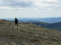
Looking west from South Baldy, Kananskis Country

Looking west from South Baldy, Kananskis Country

Monday, 29 June 2009

Weekend in Golden

Just back from a great weekend staying with friends near Golden, BC. What a fantastic location! We paddled down the Columbia River, did a couple of MTB rides, and hiked down the Kicking Horse ski hill trails. My legs are sore, and I was pleased that we'd done so much exercise, but I've just noticed bruises all down one leg, suggesting that my general ineptitude at steering and sitting on a mountain bike may be responsible instead. We biked on Mount 7 and Moonrakers trails - fantastic trail networks that made me wonder why Calgary is so short on such facilities.

I had to post these pictures, although the trip photos are here. Someone had left their trash out and this young bear had been attracted into their garden. Although I managed to get a great couple of shots while Mark was scooping up and binning the refuse, I was sad and angry, as there's a good chance that this bear will end up getting shot as a result of people's laziness. CLEAN UP YOUR TRASH! The lesson ends....poor bear.

Tuesday, 16 June 2009

Road to Nepal

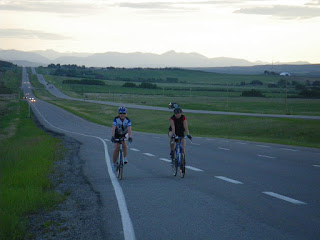
View of Elbow River area of the front ranges from summit of Road to NepalJust back from a gorgeous evening's riding southwest of Calgary. We rode the hill that I know as the Road To Nepal, but Natasha's club think that this road is the next hill to the east, which caused some confusion on our ride. I'm not sure who's right, and the name could apply to either road. Both are hilly, although only one of them has a fantastic view of the mountains from its summit (picture on left). This hill climbs steadily for about 5 km , then swoops down to meet what Lou and I call Coots' Ponds Road, and the circuit returns from there via 22X. I do have a reputation for underestimating distances on rides and hikes sometimes, and unfortunately tonight I excelled in this regard, and pronounced the ride to be 'about 16 km' in length. the final distance was a touch over 39 km, and I don't think Tara was amused at the extra 23 km, or the hills after the Road to Nepal that I'd conveniently forgotten about. Sorry! Next time I'll measure it out beforehand. It was a fantastic evening to be out on the roads though; the thunderstorms passed us by, and the views remained brilliant right to the end.Late evening, looking back down 22X from the edge of Calgary.  Riders: Tara and Natasha


Sunday, 14 June 2009

Vermillion Lakes, Banff

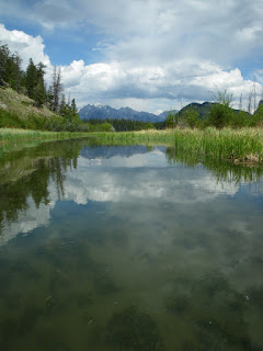
Channel linking the first and second lakesThis is a really scenic place to dip a paddle, although the water is generally very shallow and the bottom sediment stinks when you stir it up. The views are pretty special though! The launch point is from one of a few spots along the two lakes, which are joined by a narrow channel. Out of melt season this channel (and the lakes) may be impassable to boats. There is also an access route via a narrow winding creek from the rental concession in Banff, although I don't know what the rules are on that one.

This was a nice afternoon trip from Calgary, following a pleasant 40 km bike ride that I did in the morning with Hamish - our plans for riding the Jasper-Banff in seven weeks' time are slowly coming together - now in addition to the seven bikes we'll be taking two kayaks for evening R & R after riding. You could be forgiven for thinking this trip will be a holiday!

More pictures of kayaking on these lakes can be found here.

Mt Rundle

Snow in Calgary

This was the view of our front lawn on June 6th. Visitors sometimes ask us what they should pack for a holiday in the Rockies....everything?!

Saturday, 13 June 2009

Highway 66 Elbow Trail Ride

Awesome scenery, open roadsThis was an awesome ride! The weather was great and we started early, avoiding the traffic. There are a few hills and I'd forgotten my helmet (again) so I tried not to go too fast, but one hill in particular was so long and straight that I still hit 74 kph without pedalling - I'm glad I didn't fall off, as it might have hurt a little. Ride length: 65 km; riding time 2.5 hours. There are a few hills, but on the plus side, they sell beer and Australian pies in Bragg Creek, which Returning along the Elbow Rivermay compensate for the pain...

More pictures of this ride here

Sunday, 7 June 2009

Nine Hills Ride (Millarville area) again

Tara happy to be finishing the rideThis is a great fitness circuit and it's the third time I've been out in it. This time I was riding with a couple of triathletes and I was worried I'd get my fat ass kicked The third hillon the hills. It turned out to be tough going because of the wind. Natasha had already done a long open-water swim that morning, and fortunately Tara isn't yet totally happy about pushing it on the downhills, so I didn't get left behind, but it was a good pace, with a top speed of 75 kph on the fifth or sixth downhill. We managed the 40 km hilly circuit in 95 minutes. Lou came out with us and kindly took some pictures of us, in between visiting her nature photography haunts. More ride pics here

Cable Gullies Ice Climbs - In June

Lake Louise, Cable Gullies visible at far end of the lakeGrant never gives up on ice climbing. Somewhere there will always be ice to climb in the Rockies, and he usually has a good idea where to look. So with just three weeks to the longest day of the year, and Calgary enveloped in a rare summer snowstorm, we headed to Lake Louise, Tourist Central. Braving the coach-borne crowds of estuary, Yorkshire and Lancashire accents, we hurried down the lake, to find three climbs still in decent condition. So if you're wondering when the season ends out here:....'not yet!'


Cable Gullies, left-hand and centralGrant leads central Cable Gully, WI3

Tuesday, 2 June 2009

Volcano Ridge Loop

Moose Calf In Sheep Valley With winter still not leaving the high mountains, we took a day off work to go hiking in the edge of the Front Ranges. At 2110 m high, Volcano Ridge is a minnow beside the whales that form the local skyline: Bluerock Mtn, Mt. Rose, Threepoint and Cougar Mountains. It makes for a fairly leisurely 19 km day with about 600 m of ascent, if completed as a loop from the southern end of the Gorge Trail.

The hike follows signed trails all the way, although as usual the sign boards have been defaced by young (?) neanderthals learning how to use rocks as primitive tools, so take a map. The trail winds pleasantly through grassy meadows for a while, then starts to climb, before a second meadow stretch and a final 250 m steep section across an open hillside, to the summit. Here, great views of peaks from Moose Mountain round to Bluerock Mountain await. Calgary is visible in the distance on the prairie. The descent is steep - too steep, really, and will have your knees aching.

On Volcano RidgeThe highlight of this trip was the various wildlife signs and encounters along the way. Seeing what we thought to be a wolf track was quite exciting, but finding fresh bear tracks 23 cm in length was a little more scary; the jury is out on the type of bear, but it was a big one. We also saw a moose cow and her calf on the drive in. More dramatic but ultimately funny was when we heard branches snapping, and Lou whispered 'I just saw something cross the trail behind us - it had a long black tail'. Bears don't have tails, and cougars don't have black ones, so we went to look.....only to find a big, clumsy grouse clinging to a nearby tree, lookng shifty, and a second one running off into the forest. Quite a relief! I took several more pictures from the hike, which are on my Picasa site.

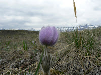
Crocus and Bluerock MtnSnow on summit ridge

Monday, 1 June 2009

Lake Minnewanka MTB

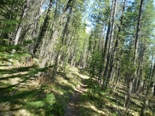
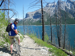
It's not Cannock Chase, but it'll doIt's been called 'The best legal single track in Banff National Park', and this trail really doesn't disappoint. It starts off so innocuously that you'd be forgiven for thinking it would be flat and boring all the way around the lake. A couple of rock steps after a km or so set the scene though, and soon you are busting lungs and legs on the first (thankfully the only) real hill, crossing an unusual channel (man made?) in the bedrock, and then climbing again. After that there is a scary section of narrow roller-coaster riding, on big lumps of scree, which a substantial (read 'killer') drop onAction pic, swooping trail your right. This soon eases though, and after the initial hard riding, the trail is lovely single-track, often on packed dirt, with superlative views. Due to time constraints we only managed 25 km of the full 52 km out-and-back ride, but the remainder is a definite addition to my 'must ride' list.

More photos here

Mark Nelson, Minnewanka MTB ride