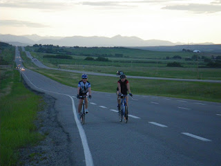
Looking west from South Baldy, Kananskis Country

Looking west from South Baldy, Kananskis Country

Wednesday, 22 July 2009

Night on Moose Mountain

Ian on the last zig-zagThe closest Rocky Mountain to the city of Calgary (I can see it from my office window), Moose Mountain makes a great evening's MTB ride. You can ride it from Highway 66 if you have the time and energy (around 30 km and 1,000 m of climbing), taking advantage of the Moose Mountain Bike Trails Society's trail network, or you can drive to the top of the oil access road and cut the trip to a mere 15 km and 350 m height gain. We opted for the latter, and I was glad of it - we finished not far shy of darkness.

For this ride I was joined again by Ian Stewart, and the weather was perfect; after a hot day a light breeze was raking the mountain. The early trail sections are generally rolling, with good packed dirt, after an initial iffy 50 m downhill on loose cobbles and rock - 'Iffy' as in, 'If I fall off at this speed, will I break my leg?'.False summit

The crux of the route is the xig-zags, which are a mixture of ridable stone and deep gravel, particularly on the hairpins. I pushed several times on this section, but the scenery was good enough to take my mind off it. We were overtaken by fell runners here, too. Those guys were so fast that we failed to catch them again on the downhill.


After the zig-zags, the false summit. This is a lovely open bit of ground and the point where the views to the west start to open up. Last night visibility was perfect and the mountainside deserted - for me this was what it's all about.


Eventually you have to ditch the bike and hike the last few hundred metres to the summit. The fire ranger Fun on the descentthere invited us to ride the path back down, but that looked like a sure route to blazing a new double-black diamond downhill course on the side of the mountain - we opted out. On the summit, it was hard to believe that 3 hours earlier I'd been at my desk looking across the foothills to this place.
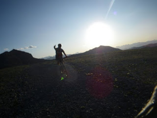
After signing the visitors' book and a quick hike down, we bombed down the mountain in a third of the ascent time. The cobbles and gravel made for some tough riding, but what a fantastic place it was to ride!


Moose Mountain from gas trailhead. ~14.5 km. More pictures here.

View from the lookout helipad

Sunday, 19 July 2009

Highwood Pass

Me, on the passWith less than two weeks before the Jasper-Banff ride I was feeling a bit under-prepared. Sure, I'd ridden 110 km (the length of the longest stage) through the foothills a fortnight ago, but I'd yet to stare over my bars at a proper Rockies mountain pass, and was concerned that my current combination of legs and cogs might be insufficient to get over the dreaded Sunwapta Pass on the Icefields Parkway. So I teamed up with Neil Campbell, a fellow Jasper-Banff rider, and we hit the Highwood Pass in K Country. Neil made a loop of the ride, from Barrier Lake to the first winter gate, but I had the advantage of a lift home waiting for me on the far side of the pass, and continued over the summit and down to Cat Creek, near the second winter gate, beyond. I'm glad of that - traversing the pass seemed far more satisfying than just reaching the summit.

Route mapThe first 40 km climbed and swooped continually, gaining overall height slowly to the winter gate. Approaching the FortressThere is a decent hard shoulder on Highway 40, and we were able to stay out of the stream of trucks and RVs headed to the campgrounds of Kananaskis. The views on this side of the pass were familiar, but great, as ever. Here's Neil near Evan Thomas, heading towards the Fortress.

We parted company at the first winter gate, and I checked in with the radio to make sure my lift home was still on, then dropped a few gears and started up the pass.

Starting up the pass properThe climbing wasn't too bad really, although my legs were sore at the top. I didn't put a foot down between Fortress Junction (about 38 km) and the summit (62 km). I stopped at the summit for a quick photo - this was my first ever mountain pass I think, certainly in Canada - and then tucked in my elbows and headed down the road deeper into the quiet country that lies beyond.
On the summit, 2200 mMy average speed on the 20 km after the summit was over 50 kmph. I was too tired to try pushing it very high, but it was comfortably close to 70 on the steeper stretches. There are no hairpins on this pass, so it's a joy to coast down and I had a big wind-stretched grin on my face for many minutes.

Eventually I reached Cat Creek at 97 km, in just under 4 hours of riding. After a lie in the sun and no sign of my lift home yet, I decided to ride a bit more, so I headed back up the pass, eventually meeting Lou at about 104 km. Now I feel much more prepared for the horrors of the Sunwapta - unless it snows that day!

More pictures from this ride are posted here.

Friday, 17 July 2009

Sulphur Springs MTB

The weather has been pretty eventful this week. We had tornado warnings in Calgary, and pretty much every day there has been a violent thunderstorm. You have to take your chances though, so Mark Nelson and I headed out on Wednesday night to do the Sulphur Springs MTB loop in the Elbow Valley.

The storms have affected the trails, and the results are not pretty. Run-off and interflow were still flooding numerous sections of trail, and in places the path had become a fast-moving watercourse. In other locations, deep erosion ruts have appeared, and loose cobbles dumped by flash-flooding litter the trail. This is a pretty sandy, well-drained trail compared to, say, Telephone Loop, so I reckon it'll be a while before the boggier trails are properly rideable again.

The loop itself is about 11 km and contains a lot of hills - the route is shown in the Gem Trek map extract - I had walked it previously but had somehow forgotten how lacking in flat sections it was. Flat sections mean puddles and mud anyway, so maybe not a bad thing. I'd just had a tetanus jab though, and I felt like crap all the way round. On the uphills I felt like vomming and the downhills shook the arm muscle where the jab had been, like a Staffordshire Bull Terrier with a rat in its mouth. The trail conditions didn't help, and I was very glad of my disc brakes, except when we almost ran into a bear, and the squealing of rim brakes might have come in useful. It's a great little ride though and one I'll do again, for sure.

Monday, 13 July 2009

Elbow Loop MTB Ride

Enjoying Tombstone Pass summit before the descent The last couple of weeks has flown by, with yard work causing me more pain than all my other exercise types put together. The weather has been pretty hit and miss, too, with hot afternoons, thunderstorms, and tornado warnings. So it was great to get out for an MTB ride yesterday and blow off the cobwebs - especially since it's now less than three weeks to the Jasper-Banff ride.

Ian approaching Tombstone Pass summitThe Elbow Loop is a fantastic circuit. It's fairly long (44 km) and has a height gain of about 400 m over Tombstone Pass, but if you ride it anti-clockwise then there are no big hills to climb, and you get to ride the single track section downhill. Riding the other way means you have a continuous climb of several km approaching Tombstone Pass, and then a horrendous uphill to the summit. The views into the Front Ranges are awesome and for large sections of the trip you're unlikely to see many people. I rode this one with Ian Stewart, a friend from Northern Ireland, on his first ride this year - good riding, Ian! More pictures here.
Single track at the back of the loop
Single track section above Big Elbow river


Monday, 29 June 2009

Weekend in Golden

Just back from a great weekend staying with friends near Golden, BC. What a fantastic location! We paddled down the Columbia River, did a couple of MTB rides, and hiked down the Kicking Horse ski hill trails. My legs are sore, and I was pleased that we'd done so much exercise, but I've just noticed bruises all down one leg, suggesting that my general ineptitude at steering and sitting on a mountain bike may be responsible instead. We biked on Mount 7 and Moonrakers trails - fantastic trail networks that made me wonder why Calgary is so short on such facilities.

I had to post these pictures, although the trip photos are here. Someone had left their trash out and this young bear had been attracted into their garden. Although I managed to get a great couple of shots while Mark was scooping up and binning the refuse, I was sad and angry, as there's a good chance that this bear will end up getting shot as a result of people's laziness. CLEAN UP YOUR TRASH! The lesson ends....poor bear.

Tuesday, 16 June 2009

Road to Nepal

View of Elbow River area of the front ranges from summit of Road to NepalJust back from a gorgeous evening's riding southwest of Calgary. We rode the hill that I know as the Road To Nepal, but Natasha's club think that this road is the next hill to the east, which caused some confusion on our ride. I'm not sure who's right, and the name could apply to either road. Both are hilly, although only one of them has a fantastic view of the mountains from its summit (picture on left). This hill climbs steadily for about 5 km , then swoops down to meet what Lou and I call Coots' Ponds Road, and the circuit returns from there via 22X. I do have a reputation for underestimating distances on rides and hikes sometimes, and unfortunately tonight I excelled in this regard, and pronounced the ride to be 'about 16 km' in length. the final distance was a touch over 39 km, and I don't think Tara was amused at the extra 23 km, or the hills after the Road to Nepal that I'd conveniently forgotten about. Sorry! Next time I'll measure it out beforehand. It was a fantastic evening to be out on the roads though; the thunderstorms passed us by, and the views remained brilliant right to the end.Late evening, looking back down 22X from the edge of Calgary.  Riders: Tara and Natasha


Sunday, 14 June 2009

Vermillion Lakes, Banff

Channel linking the first and second lakesThis is a really scenic place to dip a paddle, although the water is generally very shallow and the bottom sediment stinks when you stir it up. The views are pretty special though! The launch point is from one of a few spots along the two lakes, which are joined by a narrow channel. Out of melt season this channel (and the lakes) may be impassable to boats. There is also an access route via a narrow winding creek from the rental concession in Banff, although I don't know what the rules are on that one.

This was a nice afternoon trip from Calgary, following a pleasant 40 km bike ride that I did in the morning with Hamish - our plans for riding the Jasper-Banff in seven weeks' time are slowly coming together - now in addition to the seven bikes we'll be taking two kayaks for evening R & R after riding. You could be forgiven for thinking this trip will be a holiday!

More pictures of kayaking on these lakes can be found here.

Mt Rundle

Snow in Calgary

This was the view of our front lawn on June 6th. Visitors sometimes ask us what they should pack for a holiday in the Rockies....everything?!

Saturday, 13 June 2009

Highway 66 Elbow Trail Ride

Awesome scenery, open roadsThis was an awesome ride! The weather was great and we started early, avoiding the traffic. There are a few hills and I'd forgotten my helmet (again) so I tried not to go too fast, but one hill in particular was so long and straight that I still hit 74 kph without pedalling - I'm glad I didn't fall off, as it might have hurt a little. Ride length: 65 km; riding time 2.5 hours. There are a few hills, but on the plus side, they sell beer and Australian pies in Bragg Creek, which Returning along the Elbow Rivermay compensate for the pain...

More pictures of this ride here

Sunday, 7 June 2009

Nine Hills Ride (Millarville area) again

Tara happy to be finishing the rideThis is a great fitness circuit and it's the third time I've been out in it. This time I was riding with a couple of triathletes and I was worried I'd get my fat ass kicked The third hillon the hills. It turned out to be tough going because of the wind. Natasha had already done a long open-water swim that morning, and fortunately Tara isn't yet totally happy about pushing it on the downhills, so I didn't get left behind, but it was a good pace, with a top speed of 75 kph on the fifth or sixth downhill. We managed the 40 km hilly circuit in 95 minutes. Lou came out with us and kindly took some pictures of us, in between visiting her nature photography haunts. More ride pics here

Cable Gullies Ice Climbs - In June

Lake Louise, Cable Gullies visible at far end of the lakeGrant never gives up on ice climbing. Somewhere there will always be ice to climb in the Rockies, and he usually has a good idea where to look. So with just three weeks to the longest day of the year, and Calgary enveloped in a rare summer snowstorm, we headed to Lake Louise, Tourist Central. Braving the coach-borne crowds of estuary, Yorkshire and Lancashire accents, we hurried down the lake, to find three climbs still in decent condition. So if you're wondering when the season ends out here:....'not yet!'


Cable Gullies, left-hand and centralGrant leads central Cable Gully, WI3

Tuesday, 2 June 2009

Volcano Ridge Loop

Moose Calf In Sheep Valley With winter still not leaving the high mountains, we took a day off work to go hiking in the edge of the Front Ranges. At 2110 m high, Volcano Ridge is a minnow beside the whales that form the local skyline: Bluerock Mtn, Mt. Rose, Threepoint and Cougar Mountains. It makes for a fairly leisurely 19 km day with about 600 m of ascent, if completed as a loop from the southern end of the Gorge Trail.

The hike follows signed trails all the way, although as usual the sign boards have been defaced by young (?) neanderthals learning how to use rocks as primitive tools, so take a map. The trail winds pleasantly through grassy meadows for a while, then starts to climb, before a second meadow stretch and a final 250 m steep section across an open hillside, to the summit. Here, great views of peaks from Moose Mountain round to Bluerock Mountain await. Calgary is visible in the distance on the prairie. The descent is steep - too steep, really, and will have your knees aching.

On Volcano RidgeThe highlight of this trip was the various wildlife signs and encounters along the way. Seeing what we thought to be a wolf track was quite exciting, but finding fresh bear tracks 23 cm in length was a little more scary; the jury is out on the type of bear, but it was a big one. We also saw a moose cow and her calf on the drive in. More dramatic but ultimately funny was when we heard branches snapping, and Lou whispered 'I just saw something cross the trail behind us - it had a long black tail'. Bears don't have tails, and cougars don't have black ones, so we went to look.....only to find a big, clumsy grouse clinging to a nearby tree, lookng shifty, and a second one running off into the forest. Quite a relief! I took several more pictures from the hike, which are on my Picasa site.

Crocus and Bluerock MtnSnow on summit ridge

Monday, 1 June 2009

Lake Minnewanka MTB

It's not Cannock Chase, but it'll doIt's been called 'The best legal single track in Banff National Park', and this trail really doesn't disappoint. It starts off so innocuously that you'd be forgiven for thinking it would be flat and boring all the way around the lake. A couple of rock steps after a km or so set the scene though, and soon you are busting lungs and legs on the first (thankfully the only) real hill, crossing an unusual channel (man made?) in the bedrock, and then climbing again. After that there is a scary section of narrow roller-coaster riding, on big lumps of scree, which a substantial (read 'killer') drop onAction pic, swooping trail your right. This soon eases though, and after the initial hard riding, the trail is lovely single-track, often on packed dirt, with superlative views. Due to time constraints we only managed 25 km of the full 52 km out-and-back ride, but the remainder is a definite addition to my 'must ride' list.

More photos here

Mark Nelson, Minnewanka MTB ride

Saturday, 23 May 2009

Paddling Through Calgary

Lou, Jakob, Rachel and Frans in front of downtown CalgaryI suppose that being European makes me expect that all cities built on rivers will have evolved around the water, and so development will have made best use of waterfront space. Calgary is defintely not one of those cities, in fact it's hard to think of a location in the city where anyone has said 'hey, let's build a restaurant or pub that enjoys the view of the river'. Instead everything is motor-oriented and the waterways of the Bow, Elbow and Fish Creek are almost untouched by development. There are exceptions: former refineries where oil seeps from the riverbank, sewage works, and large houses with 'No Trespassing' signs shoved in your face, but generally, the rivers are (sic) a natural backwater that is best explored by canoe. Just pick a day when the 'tubers' have stayed home....

Today we paddled the Elbow River from a couple of km below the reservoir, into downtown, via the zoo (for ice cream) and thus on to highway 22X. That's around 29 km of paddling, which took four hours, including a half hour for lunch. What a fantastic paddle this is; it's never difficult or scary, and you'll probably see deer, coyote, pelicans and loads of other creatures.

Startled Pelicans near Fish Creek

Sunday, 17 May 2009

Update on the ice breakup

An update on the breakup of ice on Alberta lakes, May 17.

Glenmore has been free for a couple of weeks now, but the latest from the Barrier Lake info centre is that Barrier Lake is still ice-bound in the centre, with open water around the shores. The Kananaskis Lakes are still solid, and Spray Lake 'looked like a glacier'. When is winter finally going to bugger off? It's five weeks until the longest day and only 12-15 weeks before people will be out scouting for early-season winter ice climbing again. We do seem to be suffering this year. The forecast for Monday in Calgary is around 4-6C and possible snow. Whoopee.....

Saturday, 16 May 2009

Nine Hills Ride, South of Calgary

Just south of Calgary and highway 22X there is a wealth of great cycling to be had. Today, Lou and I did a nice 40 km circuit with some lovely smooth roads, several hills (about nine, maybe) and fantastic views of the mountains.

This is a great evening or morning ride. Our riding time was around 1.75 to 2 hours, but that was Lou's first outing on the hills for a very long time, and only my 3rd. The first 10 km is pleasant riding on gently undulating roads, through horse country. Turning south onto the main local highway, you get a great continuous run on a smooth asphalt and at 20 km you start to think it's in the bag. Then you turn west towards Millarville and almost immediately, the hills start. The third is probably the worst on this ride, and is horribly obvious from several km away. After a fourth and maybe a fifth, you turn north onto the Roller Coaster Ride (112th St) which is super-smooth, but has five hills, of which the second is the highest on the ride at about 1225 m elevation. Descending this I hit 71 kph; next time I might try for 80 if there's no traffic around. The reward at 36 km is a 3.5 km solid downhill, to the finish. Doing the ride in reverse would somehow make it harder I think, and you would lose the mountain views.

Thursday, 14 May 2009

Fish Creek

Fish Creek and Moose Mountain May 13 2009Fish Creek is my local park in Calgary. It's about 10 miles long, and perhaps a mile wide at its greatest extent. Because it is situated at the bottom of steep-sided slopes, there is a definite feeling that you have stepped out of the city as soon as you enter the park, and the forest closes in. The creek flows from the Rockies to the southwest and serves as a wildlife corridor. Deer, coyote, bald eagles and osprey are fairly common in the park, plus the occasional sighting of bears, cougars and bobcats, which the City tries to relocate to the mountains whenever they are spotted. Visibility is often less than 20 m, so tracking animals down can be pretty difficult.

The park also houses cycle paths that link into the main network of pathways in the city - I can ride 20 km to work via this park and the Bow River parkway system, spending only 2 km on asphalt. On Christmas Eve I used the park to ski to work. I'm not sure I'll do that again for a while though; the snow was a combination of thigh-deep baseless powder over thick vegetation and skimmed, packed snow less than a cm thick on the cleared pathways. Neither made for great skiing.


Monday, 11 May 2009

Eagle Lake, Strathmore

Paddling under a big skyEagle Lake, on the prairie 45 minutes east of Calgary is way harder to find and access than to paddle around. Opportunities to launch are severly curtailed, and the only good spot is occupied by a caravan park. In true caravanners' nature, this means that a kayaker wishing to launch is expected to pay $7 per boat. Fortunately there is a second access point, but directions on the web are garbled. It took us a long time and a lot of dirt road driving to find the launch spot. Take highway 817, then township road 232 east. The (gravel) road north to the lake is range road 245, but there is no sign to this effect. There is a tall, brown metal farm building close to this corner. If you can see Namaka Lake on the right then you have gone too far. The launch point is a few km up the road, where the road becomes a grass track, and finally ends. It doesn't look like a great put-in spot, and the mud really stinks, but it is possible to make it out without getting wet/mucky if you udge a little.

SandpiperIs it worth the hassle? Well, the ice thaws here when the mountains are still mantled with snow. Apart from the odd moron on a wet bike, you'll have the place to yourself, and this is a very popular spot for migrating birds. We saw birds here that we've not spotted elsewhere, and there is something satisfying about watching rain sweep in across the prairie, and hearing it pelt the rushes, as you watch the wildlife from your boat.

Black Crowned Night Heron

Saturday, 9 May 2009

A Double Decker Day

Rob on Prairie MtnMy friend Rob Kinsey was staying with us again, at the end of his family holiday. Sofie and daughter Sennen headed to the zoo with Lou, so the boys were free to play, for one day only. We opted for a combination day - a hike up Prairie Mountain followed by a kayak trip on Glenmore Reservoir, then a barbeque and beers on the porch. How Canadian, eh?


If the bears don't kill you, the air probably will.

Our route up Prairie Mountain was a new one to me - I'd recently seen a couple of hikers take a ridge that branches off the Prairie Creek Trail about 1.5 km from the winter gate. This turned out to be an excellent way of reaching the summit ridge of Prairie Mountain. It's still pretty steep, but you get a view all the way up, and are unlikely to cross paths with anyone. I noticed a bad smell a few times - I put it down to Rob's guts and said nothing.

The summit ridge was covered in fresh snow, and low cloud made Moose Mountain look broody. On the last few steps I mentioned an alternative ridge that I'd noticed, which looked like a good scramble. Rob was up for descending it, so we headed down. To get to this ridge, you reverse the first 100 m or so of the summit path, then head left until you can see scree below you, and head for it. It gives a good view of the cornice on the summit ridge, which is actually quite a bit bigger than it appears from the normal route.

The rib turned out to be OK in descent, but wouldn't be much fun to climb up as there was a lot of scree. After a few minutes I could smell rotten eggs again. Rob was nowhere near me - so the other obvious conclusion (for an Albertan) was drawn - we were walking through an area of Hydrogen Sulphide (sour gas) seeps. There wasn't much we could do about it, and a decent breeze was blowing, so we tried to stick to the high ground, and got out of there, fast. The ridge eventually joins a pleasant creekside trail, which brings you to a junction with a well-worn trail after 15 minutes. The left fork then lands you on the road at the winter gate parking area. This made a nice variation on the usual Prairie Mountain routes, and took 2 hours 45 mins round trip.

Cold feetShopping By Kayak

Pelicans


I wanted to show Rob the beaver colony that we'd found on the Elbow River, but after an entertaining paddle through small waves and rain, we found that the water level on Glenmore Reservoir had dropped, and we couldn't get to the river channel. We spent 30 minutes trying, and at one point Rob even braved the cold to try to drag his boat to deeper water, but eventually we gave up. Seeing a flock of pelicans on the lake was a good compromise and so we continued, pLoading the shoppingaddling right around the reservoir. While we were near Heritage Park, Lou called me asking us to go to Safeway.....well, it's only a short walk if you beach the kayaks in the right spot, so I wandered around the supermarket in my kayak gear, getting funny looks and leaving a muddy trail behind me. At the checkout I was offered 'carry out assistance' - unfortunately it transpired that they didn't include loading shopping into kayaks in the service, so I had to decline.....

It's funny how a poor forecast will give you the hills and lakes to yourself out here: we saw three people on the summit ridge of Prairie Mountain, and two kayakers on the reservoir, right at the end. Definitely a good day out!

Update on The Ice Breakup

When does the ice break up around here for paddling? I couldn't find anything online to help me, so here's a record of how things have been in 2009.

Before May 1: No lakes clear in or west of Calgary. Bow River had cleared early in April.

May 3: Glenmore Reservoir was partially clear, but some icebreaking required to get between the south and north shores. Weaselhead Flats inaccessible. Ghost Reservoir still completely frozen, but looked like it might clear soon.

May 6: Glenmore Reservoir clear.

May 8: Phone call to warden in Barrier Lake info centre indicated that all of the local lakes (Spray, Barrier, K Lakes) are still frozen.

Monday, 4 May 2009

Breaking the ice: Glenmore Reservoir

Lou paddles on the reservoirThe gentle lapping of water against the receding ice, hundreds of wild birds screeching all around us. A steam train hoots in the distance. Snowy mountains on the skyline; fish break the water ahead of my kayak, and a muskrat sits on a rotten log off my bow. So glad I moved to the Rockies and bought a kayak to paddle in the mountain lakes.

The distant sound of a tannoy playing music from a Wild West dancehall, a distant rumble of traffic. Ah, yes - open my eyes and this is central Calgary....

May 3rd and still we have no break-up on the lakes. It's been quite a hard winter, and fresh snow is still blanketing the nearby foothills frequently. We took our kayaks to Glenmore Reservoir, about 10 minutes' drive from our house. The ice hadn't cleared, but at least we could get out onto some water at last.

Muskrat
We followed another paddler out to the ice shelf and then through it, as he battered a path to the western side of the reservoir. Paddling in ice was a new and novel experience. Breaking through is fun so long as the boat stays level. Once you're past the blockage, the bow wave from your boat trails a swishing sound behind you as it lifts the ice. Peaceful.

Through the ice Lou had a good play with her new camera and got some great shots of birds in flight.

My underwater camera got its first dunking too - here's a half-submerged shot of the shore ice.

Underwater shot


A few more shots of paddling that day have been posted here.

Saturday, 2 May 2009

When sixty-six was ninety-two.

Went out for my third road ride of the year yesterday with Simon, who is in training for an Iron Man triathlon. He selected a route from his house that heads out to Cochrane then does a quick loop past Big Hill Springs before returning. '66 km' he said - so I thought 'fine, one bottle of water, no food needed'. Big Mistake. We (I was there, so have to take some blame) missed a turning (which I wasn't aware we were looking for) northwest of Cochrane and ended up waaaaay north of our intended route. This then meant returning up the big hill out of Cochrane, which started at 72 km on the odometer (and ended at 75.5 km). Total distance: 92 km, averaging somewhere over 26 km/h. Man, my legs and backside were aching afterwards! Two things of interest happened during the ride: I met a guy from Wednesfield, England (not many of us ex-Wulfrunians out here), and I noticed the sparkling azure of the Ghost Reservoir in the distance so could plan the next day's kayak trip. Another mistake in the making....